
 | |
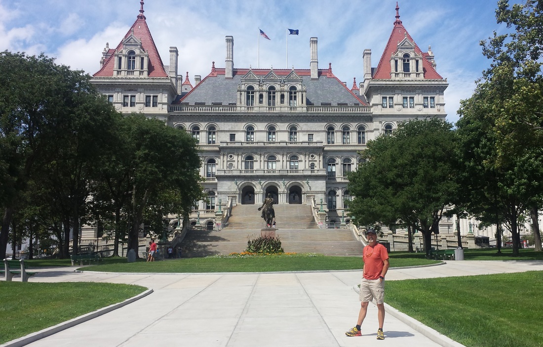
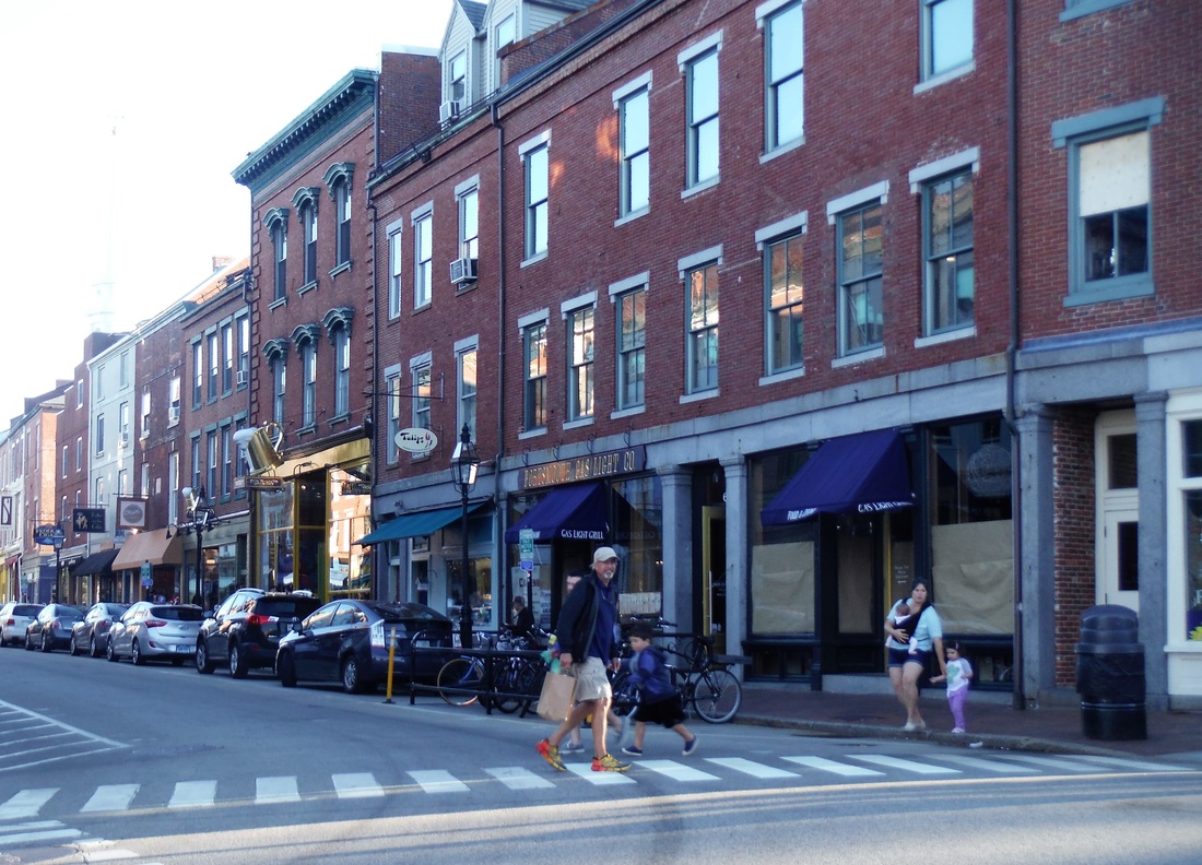
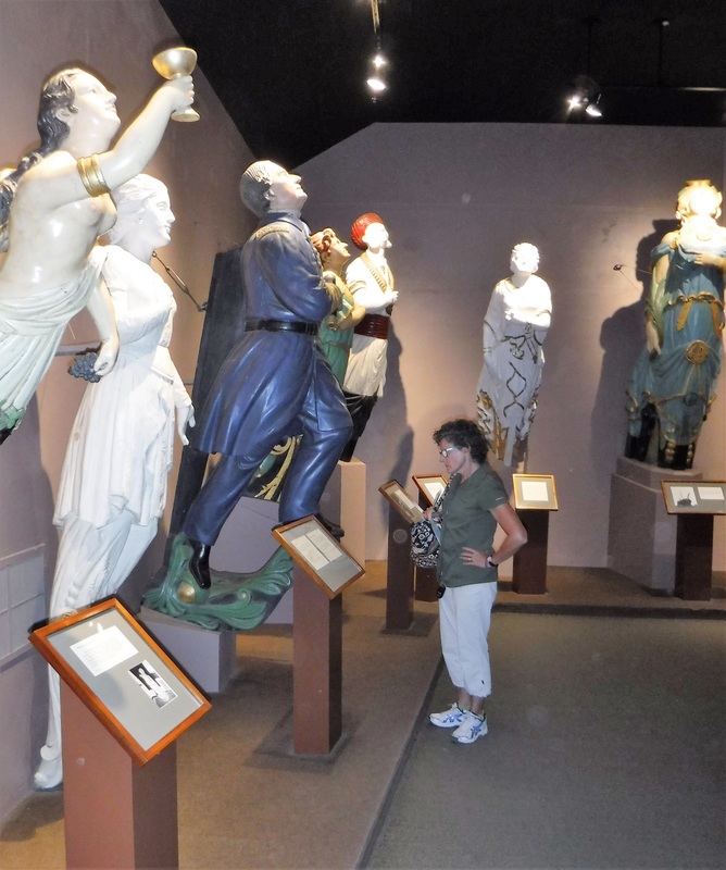
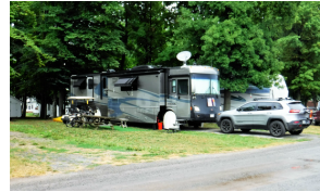
[Ken 08/24/2016] It was time to take Faith back to Freightliner for her 30,000 mile service. We found a dealer in Albany, NY, to do the service, but we would not be able to have access to the motorhome for two days. We decided to pack a suitcase and go for a drive in the Jeep ... an anniversary drive (our anniversary was last week -- the last day of our work at Lighthouse Christian Camp -- so we had not been able to celebrate).
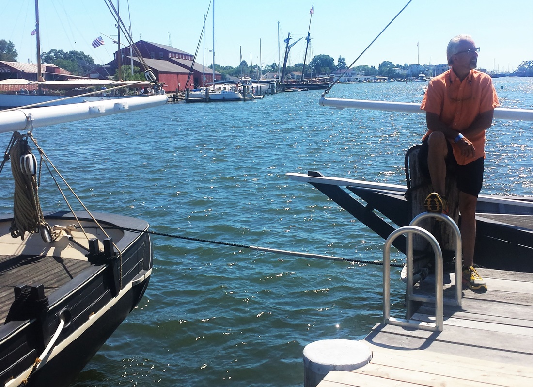
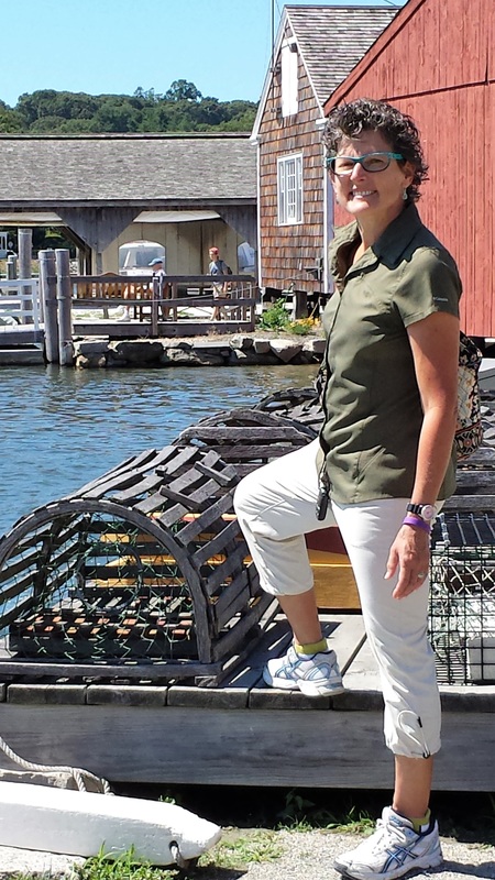
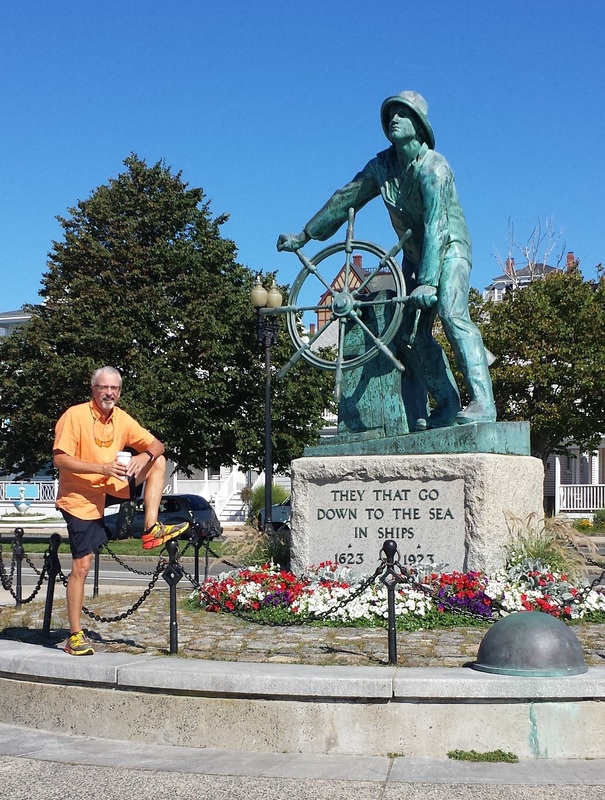
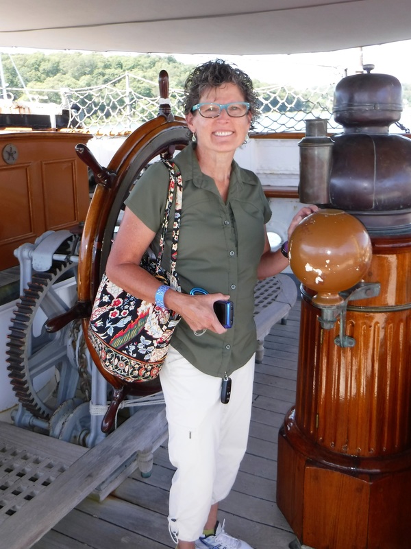
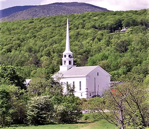
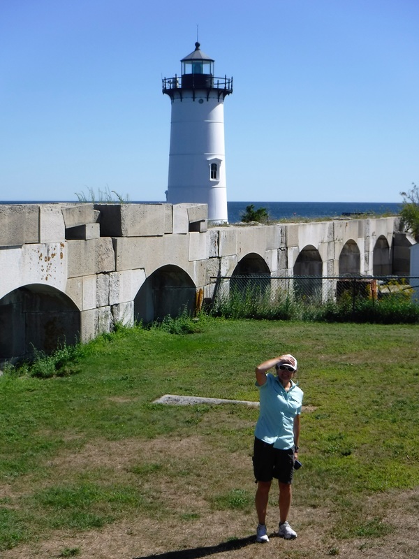
Leaving Faith in Albany, Deb and I made a giant clockwise loop through the New England region, enjoying the picturesque hamlets and beautiful countryside. We stopped at museums, monuments, forts, lighthouses, and a couple famous seaports. We lost count of how many white-steepled churches that we saw! Because of the dry season they have had, some of the trees had already started early to embrace their burgundy Fall coloring, giving us a glimpse into how magnificent a New England Autumn must look.
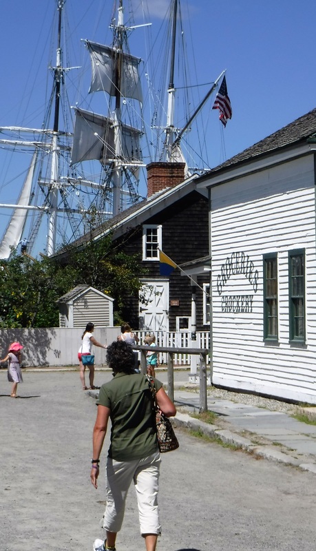
We started with a walking tour of downtown Albany, but quickly the scenic drive took as across Vermont and into New Hampshire and as far as Kittery, Maine. We then drove down the Atlantic coast to Gloucester, and past Boston before turning inland across Rhode Island and down to Mystic Seaport, Connecticut. It was a bit of a whirlwind adventure, but a great reminder of all the fascinating history, three-and-a-half century old architecture, and of how special this part of our country is!
Leaving Faith in Albany, Deb and I made a giant clockwise loop through the New England region, enjoying the picturesque hamlets and beautiful countryside. We stopped at museums, monuments, forts, lighthouses, and a couple famous seaports. We lost count of how many white-steepled churches that we saw! Because of the dry season they have had, some of the trees had already started early to embrace their burgundy Fall coloring, giving us a glimpse into how magnificent a New England Autumn must look.
We started with a walking tour of downtown Albany, but quickly the scenic drive took as across Vermont and into New Hampshire and as far as Kittery, Maine. We then drove down the Atlantic coast to Gloucester, and past Boston before turning inland across Rhode Island and down to Mystic Seaport, Connecticut. It was a bit of a whirlwind adventure, but a great reminder of all the fascinating history, three-and-a-half century old architecture, and of how special this part of our country is!

CLICK ON INDIVIDUAL IMAGES TO ENLARGE
 |
|
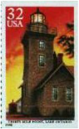
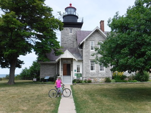
| [Ken 08/18/2016] While at Lighthouse Christian Camp we were very fortunate to have been camped on the other side of the fence (literally) from a 500-acre New York State Park. By virtue of an inviting gate in the fence, we had access to a network of groomed, wooded trails, about three more miles of scenic Lake Ontario shoreline, and the picturesque Thirty Mile Point Light -- this lighthouse has been featured on a US postage stamp. | We were in Golden Hill State Park almost every afternoon for a hike, run, or mountain bike ride. We found a loop trail that was five miles long door-to-door; it became our default route. Once we even found some tasty black raspberries hidden in the underbrush. We also had the chance to kayak into the park from Lake Ontario and explore an estuary that zigged and zagged its way into the park’s froggy wetlands. |
| | "Golden Hill" gets its name from all of the Goldenrod that grows there. And the lighthouse gets its name because it is exactly 30 miles from the light to the Niagrara River. The Great Lakes Seaway Trail goes through the park, as well. We are certainly going to miss the convenient access we had to this place. It has been very handy to have such a great group of trails and beautiful coastline to enjoy while getting daily exercise. |

|  |
Have you ever put something on your “To Do” list just so you could do it … and immediately cross it off? It’s a great feeling, huh? Everybody enjoys a sense of accomplishment. Adding something to your “To Do” list just to be able to cross it off is likely something we have all done at least once. Today, Deb and I got just such a two-fer on our Bucket List. We had never imagined that we would have an opportunity to kayak a stretch of the famous Erie Canal. Nor had we imagined we would ever get the chance to kayak one of the canal’s [newer] locks. Well, not only did we get to explore the nooks-and-crannies of this historic town, but we also got the chance to explore the canal and lock system by kayak! Bucket List: Check! ...Check!
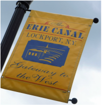
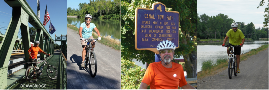
[Ken 08/13/2016] When you see the word “port” on a city name, most people would expect that city to be along a shoreline. But in upstate New York, there is a string of cities on the Erie Canal that all end with “Port.” Before the canal was even complete, manufacturing plants were popping-up along the canal’s route. The canal would play a sizable role in the nineteenth century's westward expansion of the young United States. These port cities were pivotal in the movement of raw material inland from the Atlantic region, and for shipping finished goods into the territories that were so rapidly growing in Ohio, Kentucky, and beyond. On this trip, we visited the gateway city of Lockport, New York, one of the more historically influential port cities.
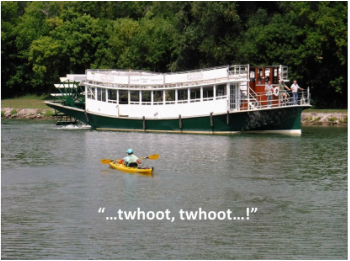
To kayak on the Erie Canal is a history-lover’s dream come true; our slow pace was even similar to the original packet boats. But there is little commercial traffic these days; most common are private boats sailing the “Great Loop” from the tip of Florida on the Atlantic side, to the tip of Florida on the Gulf of Mexico. As we kayaked our three miles on the canal, we were passed by only two boats -- one was a steam-powered paddle-wheeler!
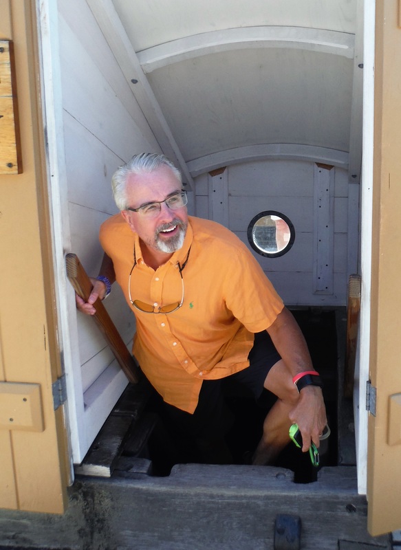
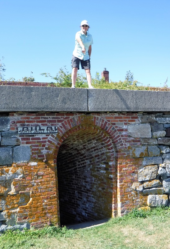
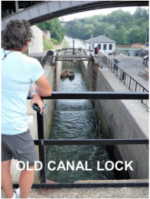
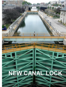
| Unfortunately for us, a sizable fire on Wednesday evening (it was even on the national news) had marred a section of the canal and Lockport's locks were closed for clean-up. We obtained permission from the Lock Master to paddle into the lower lock (No. 34) and get a close-up look at the massive doors and plumbing. The 1825-era locks were rebuilt in 1934 to accommodate the larger barges of the day – they are now 300 feet long. Impressive from above -- they are doubly impressive from down inside. | |
Lockport is a notably picturesque town. Stone from the excavation of "The Big Ditch” was used in the construction of many of the buildings in the downtown area. The historic town center is nearly 200 years old now and is still standing tall. The lock area is open to the public (it is a National Park facility) so you can walk all around/across the locks and water gates for both sets of locks.
| After stowing the kayaks, we had lunch and embarked on a tour of the town by foot. There are two free museums that explain the history of the canal and the work required to build a canal that could climb 60 feet up the Niagara Escarpment. We also did a tour of the viaduct that was dug (by hand) to divert canal water in order to turn water wheels at factories built by three of the town's earliest entrepreneurs. Today, there is a flat-bottom boat and a dead-pan guide that will take you on a damp and claustrophobic tour of the man-made cavern. | |
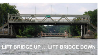
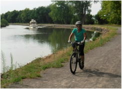
Lockport is a humble yet pivotal city in the story of America's westward expansion. We had no trouble finding things to explore and ways to spend our day. The town looked a bit like a Charles Wysocki print with all of the festive bunting and American flags. Today, a restored section of the original "Flight of Five" locks sits downtown alongside a pair of updated locks. Lockport was the only place in the world that five locks had been sequenced in end-to-end-to-end-to-end-to-end fashion. And there were two sets! Though the canal feeding the locks, complete with tow path, remains original (no less than 40 feet wide and four feet deep), the old locks have now been replaced with newer technology. And, of course, the town has a gourmet ice cream shoppe, too, "Lake Effect Ice Cream!" WooHoo!
|  |
| "Low bridge, everybody down! Low bridge, for we're comin' to a town! And you'll always know your neighbor, And you'll always know your pal, If you've ever navigated on the Erie Canal!" |
Chorus from "Erie Canal Song" by Thomas S. Allen
 | two days |
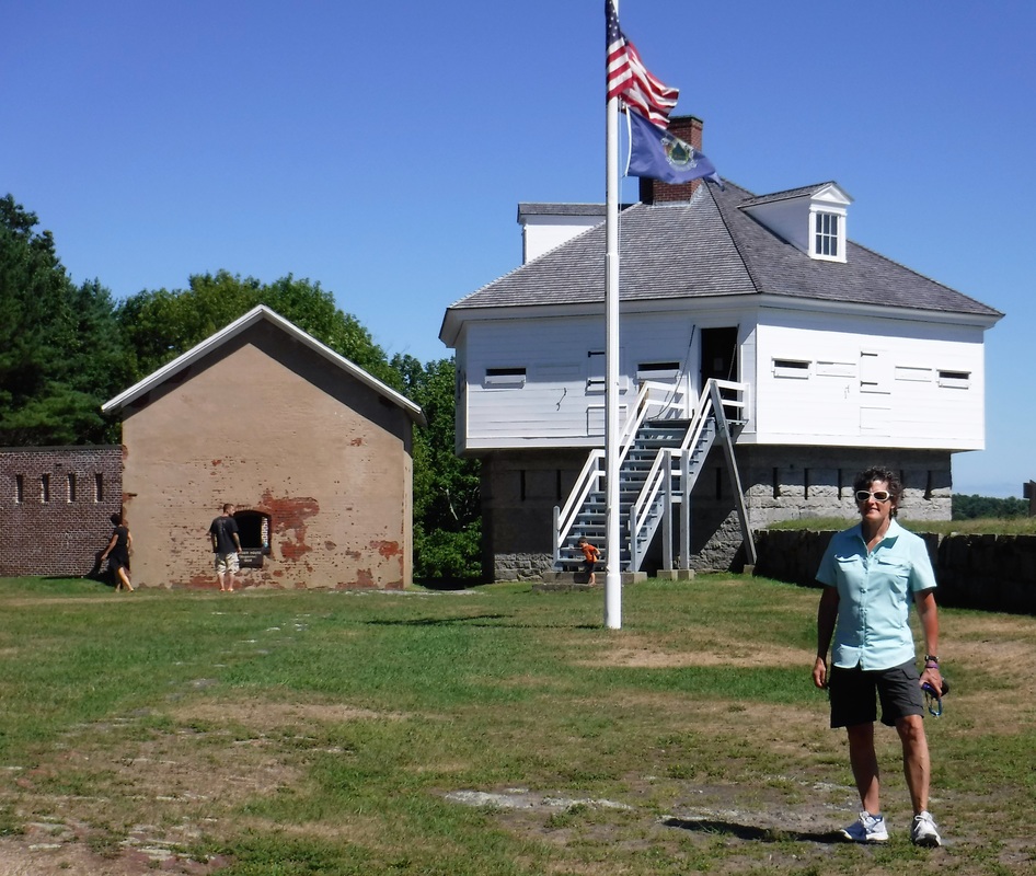
| [Deb 08/06/2016] There is so much to see in the Niagara region that we had to spend two days exploring. Ken likes forts and history, so our first stop was Old Fort Niagara. This fort is located on the eastern (New York) side of the lower Niagara River where it meets Lake Ontario. It is well-positioned to defend the mouth of the Niagara River. The Fort is staffed with costumed interpreters in French or British or American uniform – in its history, the area was claimed at some time by all three governments. | |
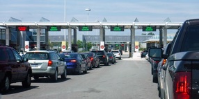
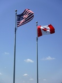
After our visit to Fort Niagara, we set out to see the great Niagara Falls. It was a Saturday and it seemed that a lot of people had the same idea. The roads were crazy and parking was scarce. We found our way into a line of cars heading across the Rainbow Bridge into Canada, so we decided to explore the Canadian part of the region first! We crept along for more than forty-five minutes waiting for our turn to visit with the border and customs official. After many questions about our missionary status, why we were visiting Canada, why we have Texas’ license plates but don’t own a gun, and how long we planned to stay in Canada, we were eventually allowed entry into the country.
| After winning the challenge to find a parking place, we hiked the entire length of Queen Victoria Park. The trail follows the Canadian side of the gorge along the Upper Niagara River, past the Falls, and down to the Lower Niagara River. It was about seven miles round-trip. The hike treated us to many views of the Niagara’s rapids, immediately alongside the Canadian Horseshoe Falls, as well as to several viewpoints of the American Falls on the United States’ side of the gorge. | |
The water in the Niagara River (and over the Falls) has a remarkable aquamarine color due to the type of rockbed found in the area; the blue-green color makes the Falls even more spectacular. We were awestruck by the power of the mighty rushing waters. There is no kayaking here, for sure! The Maid Of the Mist boat tour, however, tries tirelessly every fifteen minutes to reach the Falls from below.
As we walked along the path with the thousands of other tourists, we were enveloped by clouds of mist rising from the cascading water below. We donned our rain gear and attempted to take pictures between water droplets. A picture cannot capture the majestic site of God's creation in the Falls, let alone a lens that is covered in water droplets. It is mesmerizing to watch, feel, and hear the roar of the rushing Niagara waters.
As we walked along the path with the thousands of other tourists, we were enveloped by clouds of mist rising from the cascading water below. We donned our rain gear and attempted to take pictures between water droplets. A picture cannot capture the majestic site of God's creation in the Falls, let alone a lens that is covered in water droplets. It is mesmerizing to watch, feel, and hear the roar of the rushing Niagara waters.
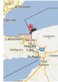
We got a tip from a fellow SOWER that a visit to Niagara-On-The-Lake would be worth-while, so we drove northward to adventure through this small Canadian town (see the red paddle marked "A" on the right). At a carefully paced 50km/h highway speed(?), we followed the Niagara Parkway from Queen Victoria Park past dozens of established, estates, vineyards and wineries which overlook the captivating Niagara River Gorge. We judged by the elaborate landscaping and stone-arched driveways that this was an affluent part of Ontario. In any event, it was a very pretty drive. We also noted a scenic bike path that connected the Falls area to Niagara-On-The-Lake; we will remember that ride for our next visit, for sure!
| | This picturesque three-century old village sits on the lower Niagara River where it meets Lake Ontario. The updated town has managed to keep its 17th century Canadian charm – its appeal is not hidden by any of the thousands of wonderfully colorful flower boxes and gardens. The streets are touristy with many interesting shoppes and eateries. Ken said the town reminded him of Savannah with a pinch of Mackinac Island and N'Orleans thrown in "...just for good measure." |
Fort George is located on the eastern edge of the town and became the British stronghold once Fort Niagara, catty-corner across the River, fell into American hands. It is interesting to note that the Visitors Centers at both Old Fort Niagara and Fort George report victory in the War of 1812 belonged to their respective government. I wonder who actually won the War of 1812? All we know for sure is that it was not the French!
| On the Friday after we visited the Canadian side of the Falls, we set off to explore the American side. From downtown Niagara Falls (the City), we hiked an eight-mile loop that took us to viewpoints on Luna Island, Goat Island, Green Island, Terrapin Point, and all along the Niagara Falls State Park shoreline (Trivia: NFSP was the first state Park in the USA). The waters heading toward the Falls were just as fierce on the US side as the ones on the Canadian side. | |
On the American side you get to overlook the top of American Falls and Bridal Veil Falls. At the bottom of the Bridal Veil Falls were dozens of people in yellow “raincoats” (plastic trash bags turned upside down and with a neck-hole added in order to be used as a poncho). They were crowded onto a walkway that leads right next to the base of the downward-determined water. Watching from above, we just shook our heads as young boys stood as close to the waterfall as you can get. In spite of their "raincoats," they were soaked. Though the crowd was lighter this day, there was still a line of tourists cautiously waiting to join them under the falls and get drenched. Good for us -- the smaller crowds made the views easier to come by. It certainly is a spectacular area.
The Niagara Region is something to experience if you ever get a chance. In spite of the crowds, it is a must-see visit. We could easily spend a third day in the area exploring boat rides, caves, and bike paths. So when you put "Niagara" on your Bucket List, be sure to reserve three very full days.
The Niagara Region is something to experience if you ever get a chance. In spite of the crowds, it is a must-see visit. We could easily spend a third day in the area exploring boat rides, caves, and bike paths. So when you put "Niagara" on your Bucket List, be sure to reserve three very full days.
another front yard
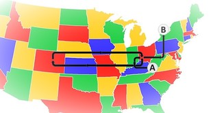
July was a busy month for us. From Point A to Point B, we traveled about as many miles in the month of July that we had on the whole rest of the trip since we left home last year! In the end, we made our way to the stony shoreline of beautiful Lake Ontario in upstate New York. It feels really good to be settled for a while.
[Ken 08/01/2016] We are blessed to be serving this month at Lighthouse Christian Camp between Buffalo and Rochester, NY. While we managed through the heat and humidity of Tennessee, Kentucky, and Ohio, here we have most pleasantly discovered that life on the edge of Lake Ontario is "air conditioned." When the wind blows from the north, the “lake effect” provides a coolness to the sunny, humid days that makes it feel like we are inside an air-conditioned building. I hear that there is another temperature extreme here during the lengthy winter season (we won't be here long enough to experience that, fortunately). In contrast to the many prolific orchards, all of the green grass, and all of the water in the area, rain in the region is relatively uncommon, we hear. Maybe it does not matter with all of the cool, misty air around?
There is a lot to see and do in this part of the country, not the least of which is a visit to the Niagara river region and the most iconic of all waterfalls. We can do a trip into Canada. There are six lighthouses nearby, and the Erie Canal runs east-west about 25 miles to the south of us. There are berries to pick and wineries to tour in every little village. The area was settled by the French and the British before it became an American colony, so there is a lot of history here, too.
Toronto is just 52 miles (as a crow flies) westward across the lake. As the sun sets at the end of a clear day we can see the silhouettes of the downtown capital city's sky-scrapers. Some other area factoids that I found interesting:
Toronto is just 52 miles (as a crow flies) westward across the lake. As the sun sets at the end of a clear day we can see the silhouettes of the downtown capital city's sky-scrapers. Some other area factoids that I found interesting:
- Did you know that over 90% of the water in Lake Ontario is actually water from one of the other Great Lakes?
- Did you know that Lake Ontario is, by surface area, the smallest of the Great Lakes? …but actually contains more water than Lake Erie?
- And did you know that it takes a single drop of water approximately 370 days to flow from Duluth, MN, to Lake Ontario?