
trouble, then fire!
< A SAGA >
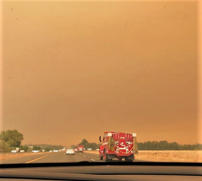
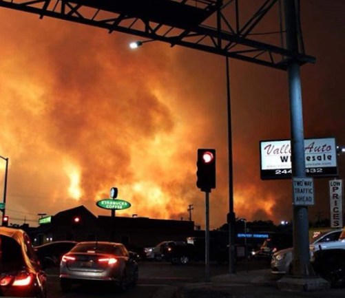
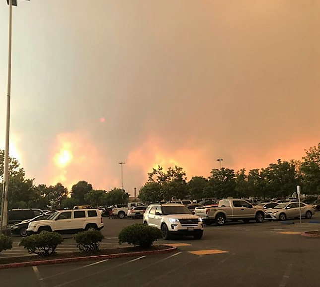
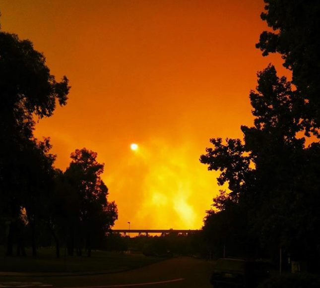
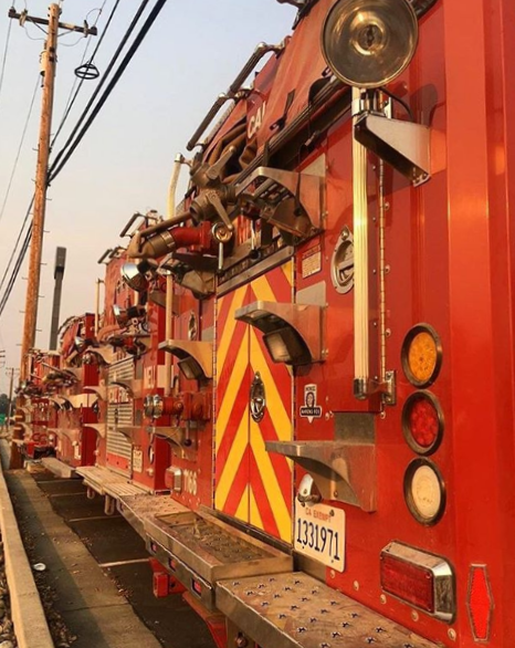
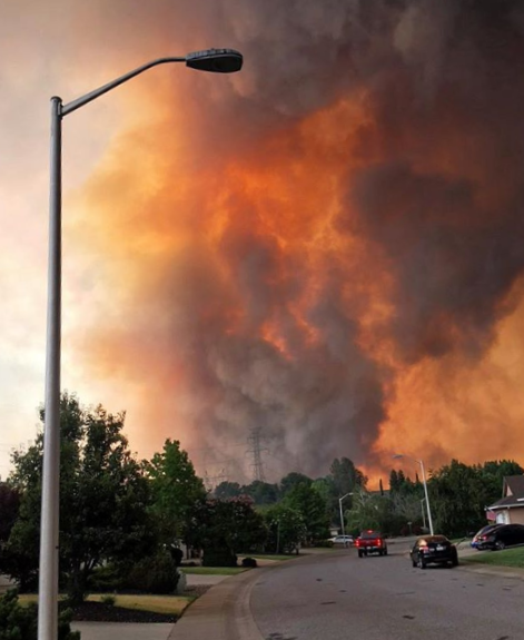
| We were only about ten miles outside Lassen Volcanic National Park when Ken noticed the gauge for the primary air tank on Faith (our motorhome) – the tank was not holding pressure. He pulled over, fearing that the air pressure would drop too much and he would lose the ability to control braking. God provided a nice, wide spot beside a bubbling creek for us to stop safely. At the time, we were crossing the northern Sierra Nevada’s at about 4500 feet in elevation between Redding, California, and Reno, Nevada. There was no cell signal or Internet access. We were at eastbound mile marker 61.89 on California HWY 44. Most people call this part of California “the middle of nowhere.” We were fortunate to discover that the Pacific Crest Trail poked out of the woods just down the road. And where it appeared there was an emergency cell station for hikers of the PCT. It came in handy for us; we used it in order to locate and get a tow truck to come to our aid. The tow truck showed up as promised. But instead of towing us, he simply filled Faith’s air tanks which would allow Ken to drive the motorhome “normally” downhill to the Freightliner shop in Redding. It was an exciting trip because Ken did not want to use the brakes (using the brakes consumes air pressure). Going down a mountain and not using the brakes … hmmmmm? 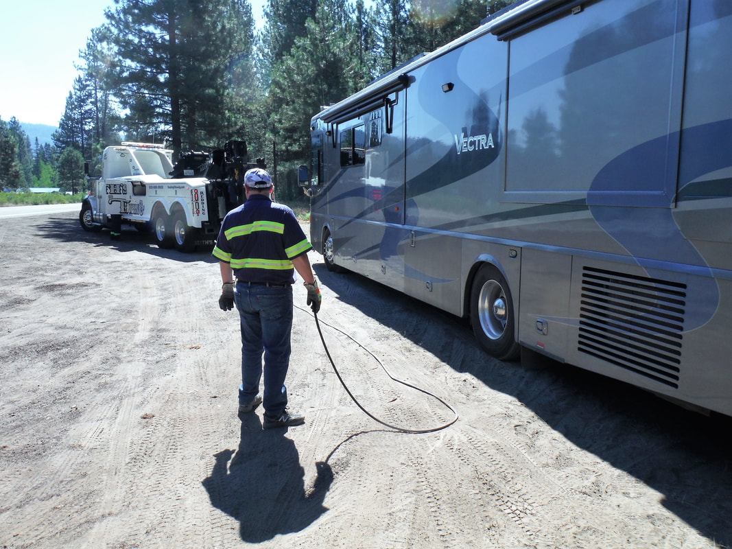 As he descended from 4500 feet to 300 feet in a cautiously managed 62 mile drive, Ken slowly followed the tow truck down the winding mountain road. He made it the whole way without touching the brake pedal except when he had to come to a stop behind the tow truck. He had never appreciated the engine’s compression braking system more! Whew! We checked in at Freightliner in west Redding and a quick diagnosis indicated a failed cartridge in the air dryer. Unfortunately, they did not have the part in stock. They promised an overnight delivery of the needed part, so Deb and I checked into a local motel. It was just about the same time that an adrennaline-filled Ken pulled Faith off the road in the Sierra Nevada’s, that a trailer blew a tire on California HWY299 near Whiskeytown Lake, about 100 miles away. When the trailer tire blew, the wheel’s rim scraped across the ground and, causing a stripe of sparks on the highway, started a small roadside fire. That small fire would grow to become the Carr Fire, infamous in the history of northern California for [at the time] being the area’s largest and most explosive wildfire ever. Unbeknownst to us, the Carr Fire advanced eastward overnight and by morning was threatening the western side of the city of Redding. The area where the Freightliner shop is located, where Faith had spent the night, was already evacuated by the time that we had climbed out of bed. All of a sudden, our brief diversion to Redding had become an extended stay. Our chance to get back to Faith to collect more clothes and meds had closed without us even knowing. It was the travel week for SOWERs – the week we have each month to get from one assignment to the next. We were Group Leaders for the August project and were expected to be at Sugar Pine Camp in two days. It was not looking good for us to be on time for that arrival deadline. Ironically, the Ferguson Fire near Yosemite, is simultaneously burning just a couple miles north of Sugar Pine Camp. We were going to be dodging fire and smoke no matter where we spent the next week, it seemed. 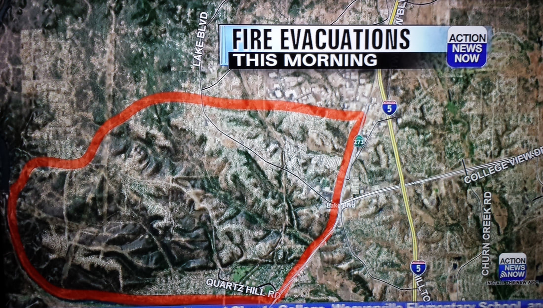 | Driving around the town of Redding was eerie. Under normal conditions this is a beautiful city surrounded by beautiful mountains. The horizon is dotted with forests and lakes. Palm trees line the streets. The Sacramento River flows through the center of town. But the smoke obscured all of that, not to mention the sun and the moon. About one-third of the city had been evacuated -- those who remained were staying indoors to avoid the unhealthy smoke. Many of the streets were virtually empty except for police and fire trucks. Helicopters and retardant drop planes, in support of the ground-based fire-fighters, flew overhead. 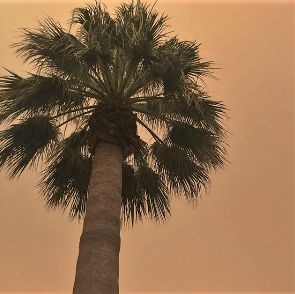 Television reports of the condition of the city were not encouraging, either. The spirit of the city was waning by virtue of the fact that 175 square miles of land (at the time) along the west side of the city had burned (for reference, the city of San Francisco is 47 square miles). In spite of the fire fighter’s best efforts, after six days the fire was only 5% contained; after a week it was only 20% contained. Each day we hoped for the evacuation order to be lifted and for enough staff to show up at Freightliner to be able to repair Faith. But we had now been in the Redding motel for one week. At this point, we recognized how trivial our troubles were in light of the Carr Fire and the 1000+ homes that had been consumed by the fire. We had kinduv become numb in our concern for Faith: If it ends up in the path of the Carr Fire, so it will be. God is in control. There is nothing we can do about it. As a matter of stewardship, we wanted to get busy. We made a few phone calls to see where we could go. That was the morning when we started the Jeep and it showed about a dozen fault codes on the screen. Getting it in gear was like a bucking pony – but we got it to move and drove right to the local Jeep dealer fearing the worst. Would it be that we could soon be without either of the vehicles that we drove into Redding? Fortunately, the part of town where the Jeep dealer was located had just received repopulation orders from the fire chief that very morning. Better yet: In about three hours they had diagnosed and fixed the problem. Whew! 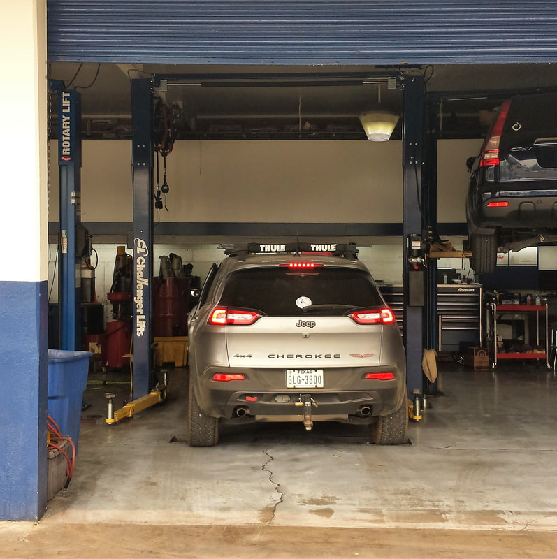 One of our phone calls paid off. We were able to return to Kidder Creek and stay in one of their trailers (without our motorhome). They made accommodations for us to stay in their RV Park. We checked out of our motel the very next morning and drove to Kidder Creek. We will return to Redding when Faith ha been determined roadworthy. Or not. It is out of our control at this point. When ee learned that the evacuation order for the Freightliner part of town had been lifted, we checked to see if our part had been received. They said it had not. In fact, Freightliner said the part was “AWOL” – after checking with the carrier the team at the shop did not know where it was. It was assumed to be in the terminal near the airport with the thousands of other packages that had come in during the fire. Surely it would surface in a day or two, right? Freightliner gave up waiting and re-ordered the part for us. It came the next day and was installed in less than twenty-four hours. Bravo team! |
From the time the air dryer cartridge failed to the time we picked up Faith it had been thirteen long and anxious days. We eagerly returned to smoke-filled Redding to claim our home-on-wheels. It felt great to finally be back on-the-road! Sugar Pine Christian Camp -- Here We Come!!! WooHoo!


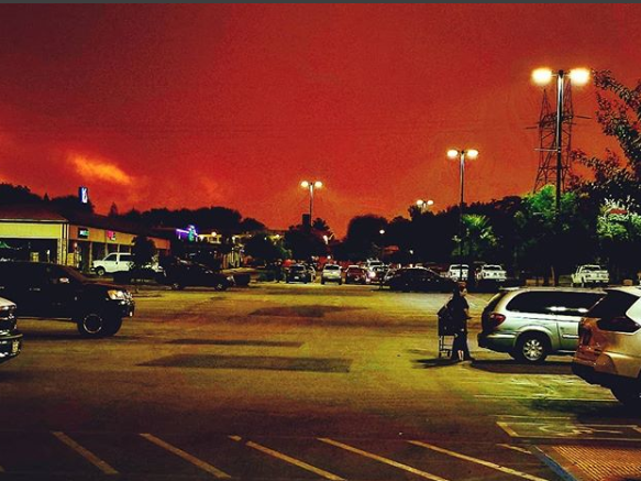

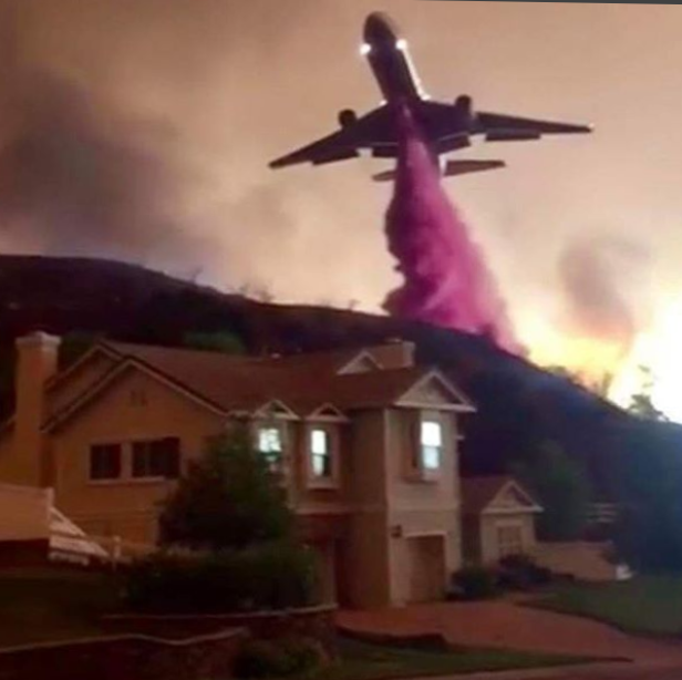
REDDING PHOTOS ABOVE FROM TV AND THE INTERNET
 |
|
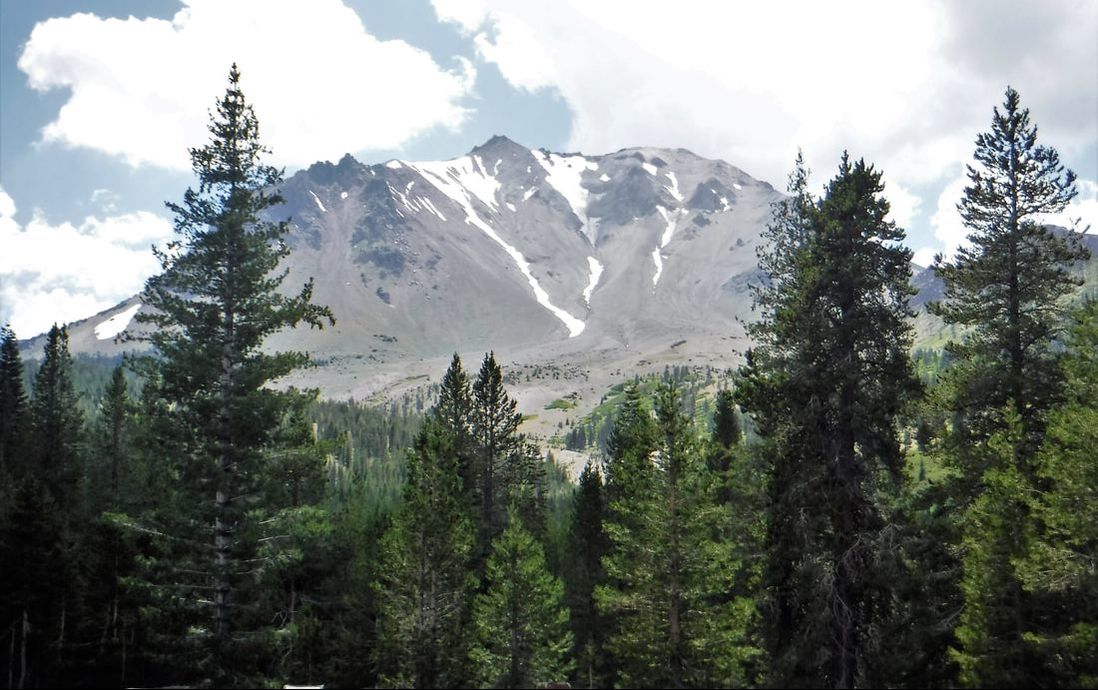
[Ken 07/23/2018] This high-mountain park is another one of those off-the-beaten-path gotta-see places; Lassen Peak is the largest plug dome volcano in the world. It is nestled at the northern end of the Sierra Nevada mountains between Redding, CA, and Reno, NV. As beautiful as the scenic drive to get there, so is the scenic, 29-mile, winding, mountain drive through the park. But as dad used to say as he was overcome by yet another great "photo op" around every turn, "It's just more of that regular old grandeur."
| Lassen Volcanic National Park is renown for its compelling history and diverse volcanic scenery. From broad lava slides and jagged crags to barren, devastated plains. And in areas of recovery, from forested mountains to blooming meadows. And from each year's snowfall there are waterfalls and small lakes. All of this in the shadow of the remnant cinder cones that off-and-on erupted in ruin from 1914 to 1917. | |
| | The park also offers several geothermal displays. There are steaming fumaroles and hydrothermal vents that spot sections of the landscape. This was the most interesting part of our visit to me. Bubbling mud pots and the smell of sulphur in the air reminded me of our trips to Yellowstone. Be sure to explore some of the trails for full sensory stimulation! |
This park is one of the earliest facilities in the National Park System. Founded in 1907 as two neighboring National Monuments, Lassen Peak then erupted in 1914. But it was the 1915 eruptions which so devastated this section of the Sierra Nevada Mountains. In 1916 the combined Monuments became preserved as a single National Park in commemoration of the eruptions. Tremors in the newly created Lassen Volcanic National Park, however, continued until 1921.
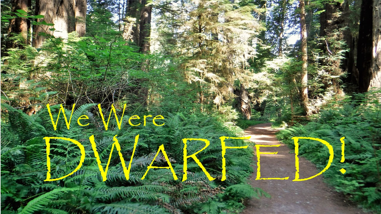
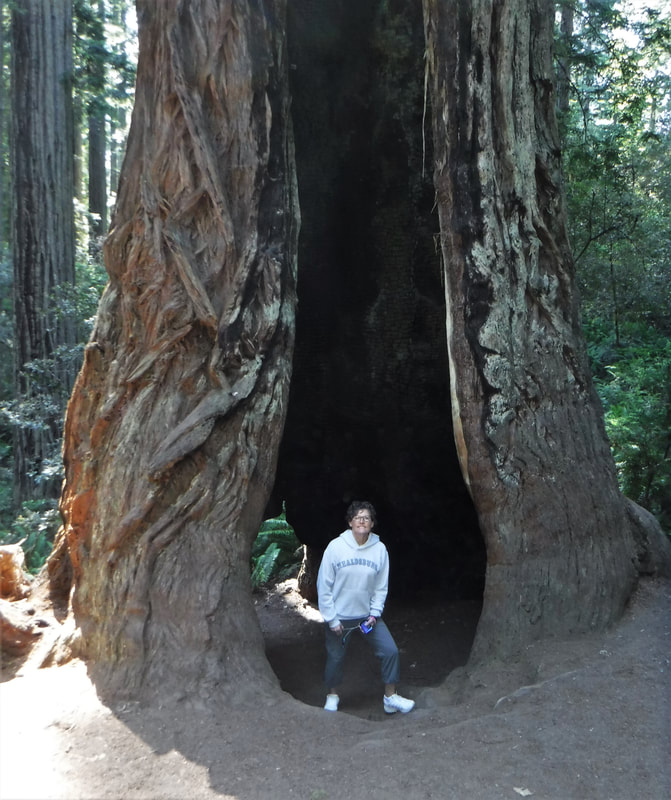
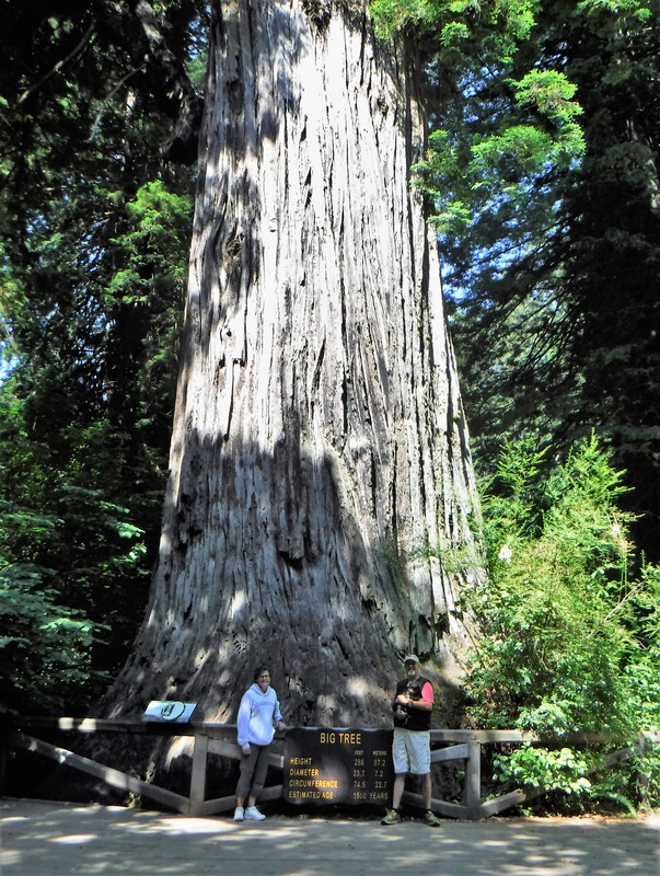
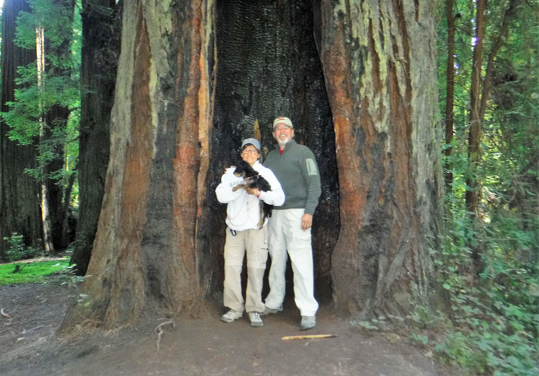
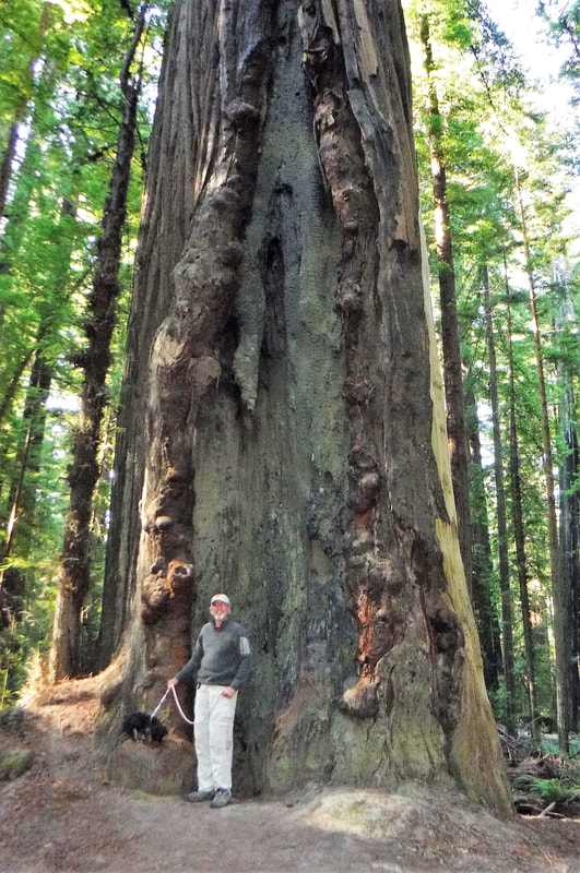
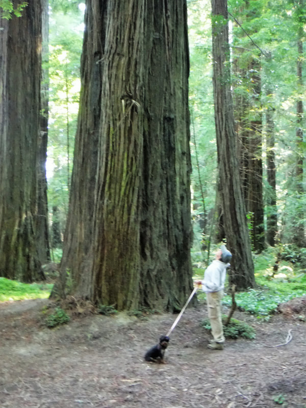
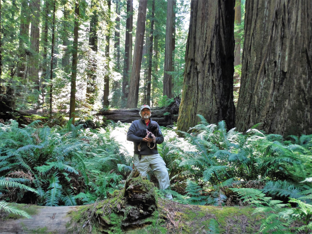
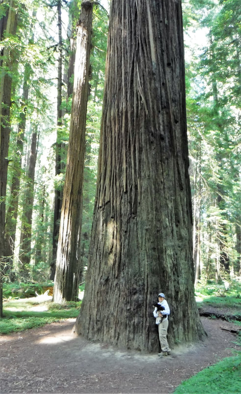
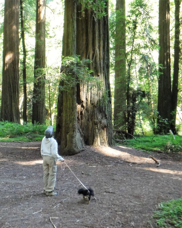
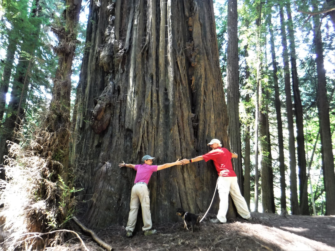
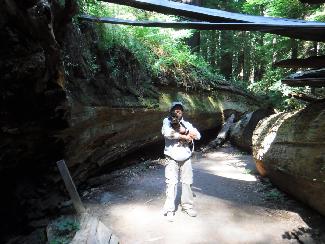
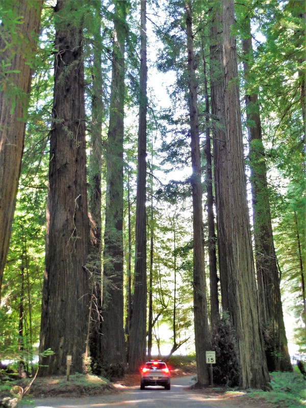
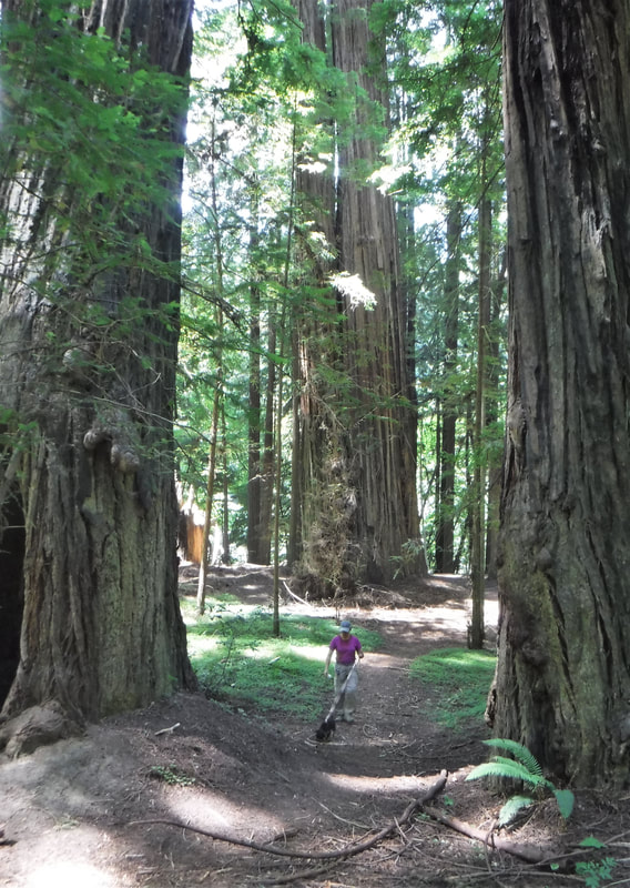
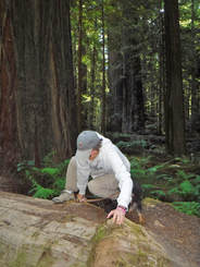
When you walk among the redwood trees your status on the size continuum of all things considered becomes clear. You are lowly among the tallest trees known to man. Exceptional redwoods may reach 350 feet tall with a trunk diameter of more than 20 feet. A single Coast Redwood takes 500 to 800 years to mature and its life can span more than sixty human generations. Many redwoods live more than 2000 years placing them among the oldest living things on earth. In these impressive forests time seems to stand still. Among these lofty giants your smallness is affirmed. You are dwarfed in all categories. It will be a humbling and awe-inspiring event.
[Ken 07/14-15/2018] Deb and I made a weekend drive to explore Redwoods National Park and Humboldt Redwoods State Park in northern California. The Coast Redwoods (Sequoia Sempervirens) grow naturally only along this section of the Pacific coast. Only here are conditions right for growing the world's tallest and most spectacular trees.
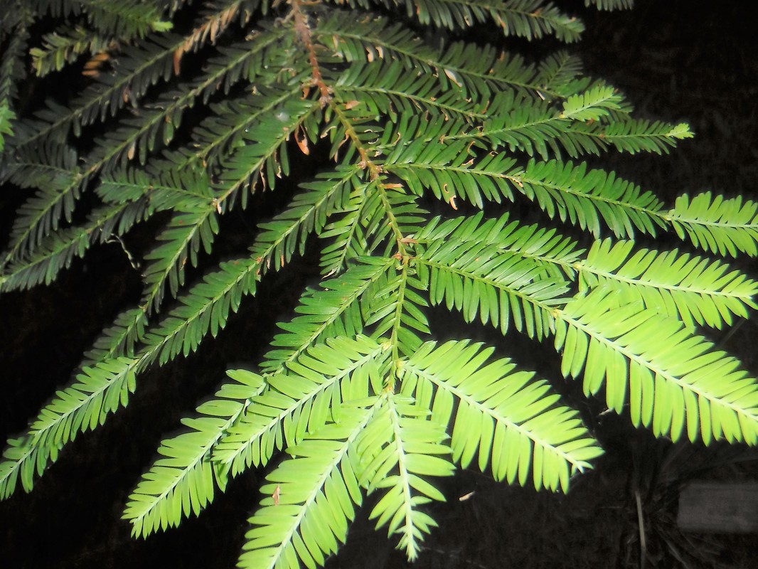
The redwood forests seem to create their own weather. As you enter a grove, you will feel the humidity increase and the temperature drop. You will notice moss and lichens and ferns growing abundantly (see this blog's title slide). The last time I was here (it was 1969, I think) I recall a slight mist and drizzle in the air as you hiked through these grand trees, but on this visit the forest was dry.
The redwood forests seem to create their own weather. As you enter a grove, you will feel the humidity increase and the temperature drop. You will notice moss and lichens and ferns growing abundantly (see this blog's title slide). The last time I was here (it was 1969, I think) I recall a slight mist and drizzle in the air as you hiked through these grand trees, but on this visit the forest was dry.
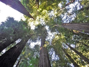
Deb commented that her neck was stiff from looking up in attempts to see the tops of these imposing trees. Their towering crowns are often obscured by other giants or washed-out by the glorious streams of glistening sunlight that have been successful in penetrating the elevated canopy above. But still you try to see the top -- the height of these majestic trees is one of their most magnificent characteristics.


CLICK ON ANY IMAGE ABOVE TO ENLARGE and SCROLL
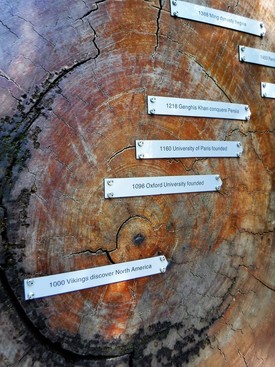
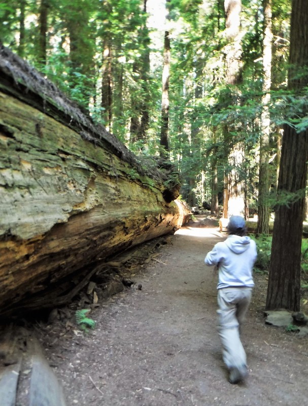
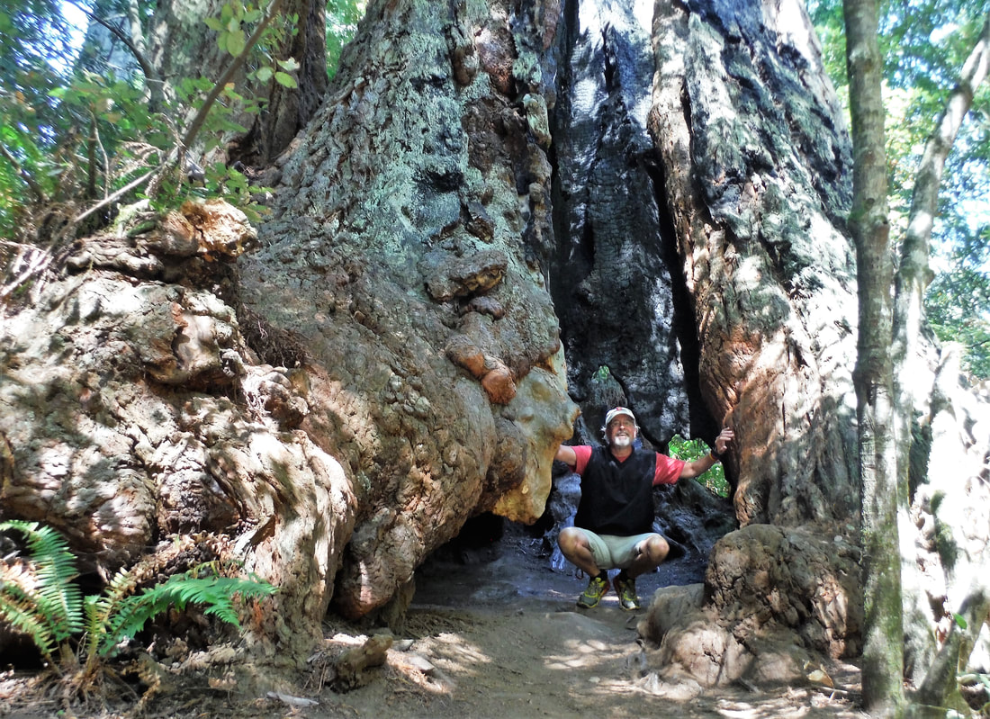
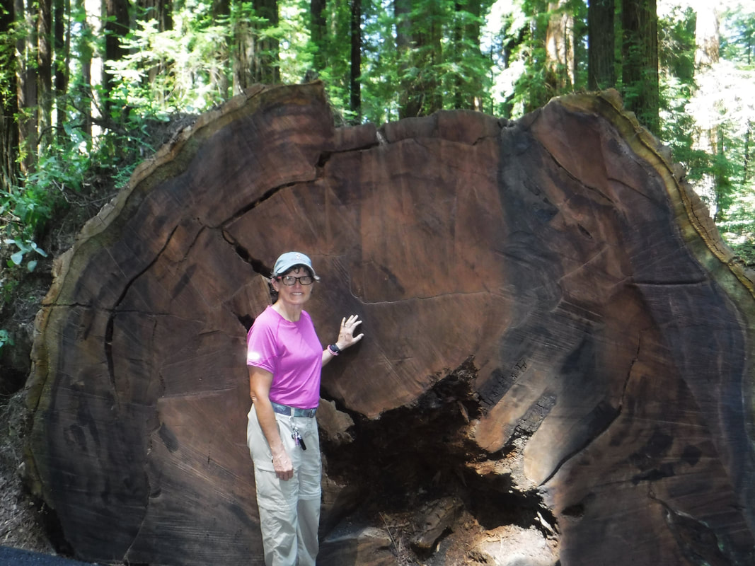
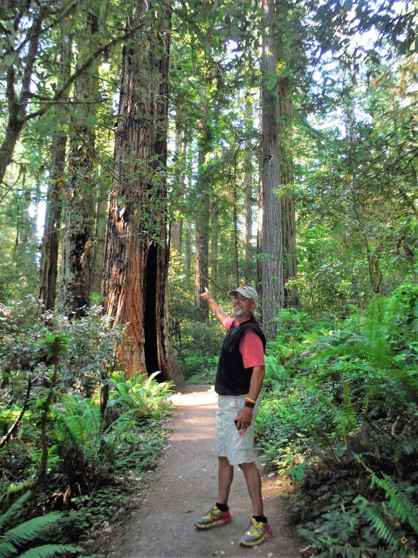
As you hike the various groves, you contemplate the tremendous span of history that these redwoods have witnessed. Many of these great trees precede the discovery of North America by hundreds of years! On the trails beneath, you become overwhelmed by the sheer size of the trunks of these trees. We saw many with a base circumference greater than fifty feet; one was greater than 74 feet around! And like any trail through any woods, there are trees that have met fate by age or fire or storm that lay, collapsed across your path. At these parks, a downed tree creates a special challenge -- how do you climb over a fallen tree whose girth is fifteen feet taller than you?!?
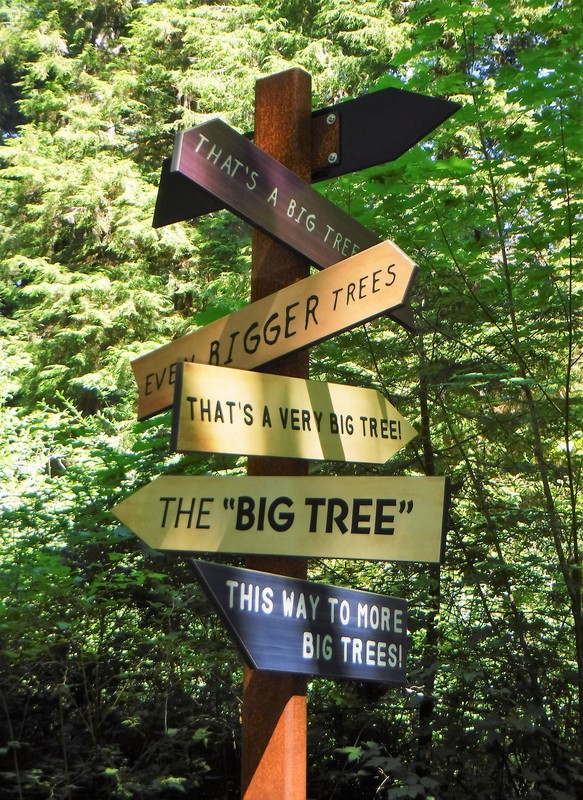
For us, this was a breathtaking two-day adventure. These parks are places where the use of superlatives is justified. The trees here are more than just trees, they are giants; they are "ambassadors." There are not ways to fully describe them or sufficiently photograph them -- the trees are too tall and you are too close. Try as you might, you will return home with pictures of tree trunks and trails. To experience the pinnacle of the redwoods, you have to visit the redwoods.

Our visit to these parks was more rewarding than anticipated. I was sent a survey for the National Park Service a few months ago. One of the questions was, "What is your favorite National Park System facility?" Having once again visited Redwoods National Park, I think I might need to change my answer.
[Ken 07/12/2018] When we saw them lying around the RV Park at Kidder Creek Orchard Camp it was kind of a novelty. “Cool,” we thought, “Something different.” Maybe even something we could collect a few of to take back to Texas where they ought not to brag about such grandiose things. "Two or three might look cute in a basket next to the fireplace," we mused. What we found at Kidder Creek, scattered in some of the campsites, amidst the standard assortment of humbly-sized pine cones, were the biggest of them all -- the bomb-shell of all pine cones: the cone of the Sugar Pine.
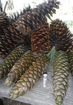
The Sugar Pine is known for two things – its striking height, reaching as much as 200 feet, and its football-sized pine cones. We are all used to seeing open, brown, dried pine cones that are two or three or four inches long and wide -- they are everywhere. But the cone from the Sugar Pine can be as long as twenty-four inches! The Sugar Pine produces the largest cone of any evergreen.
The largest cones we found at Kidder Creek were [only] about eighteen inches long. We collected a few on our picnic table. The greener ones in the picture on the left are still tacky with pine pitch and fell during our stay. The brown ones near the top of the photo fell before our arrival and are in various stages of drying and ejecting their seeds. I placed a tube of chapstick in the center of the picture to give you an idea of scale.
The largest cones we found at Kidder Creek were [only] about eighteen inches long. We collected a few on our picnic table. The greener ones in the picture on the left are still tacky with pine pitch and fell during our stay. The brown ones near the top of the photo fell before our arrival and are in various stages of drying and ejecting their seeds. I placed a tube of chapstick in the center of the picture to give you an idea of scale.
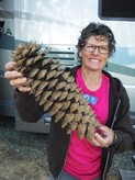
Turns out we were at this camp during the end of "Pine Cone Drop Season." We thought that was pretty neat until we were reminded that the cone from a Sugar Pine falls from about 200 feet, and while still green, weighs between five and ten pounds (before it "browns" it is a moist olive green and packed hard and full of weighty pine pitch). When the tree releases its ultimate grip on a ten-pound pine cone that is longer than a football from that high up, you better not be underneath. There is about to be a dent in the earth!
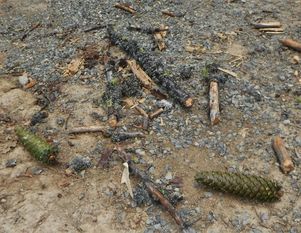 | With a succession of snaps, and breaking pine boughs, the Sugar Pine's cone hits the ground with a determined thud. Around it crashes all the coincident debris that it has accumulated in its downward wake. The racket is as if somebody unloaded a wheel-barrow of kindling and bricks over the side of a twenty-story building! It’s not possible to ignore the ear-jarring avalanche of branches and boughs as the cracking conglomeration is ultimately halted by solid ground. |
Unknowingly, we wisely opted for campsite #6 in this RV Park – it is a safe distance between two of the larger Sugar Pines nearby. I hate to imagine the damage that could occur to the roof of an RV which is fatefully parked under a Sugar Pine during "Drop Season!" Note to self: Don't camp in Site #5 during Pine Cone Drop Season!
lava "tubes" | 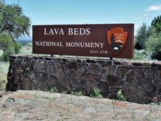 |
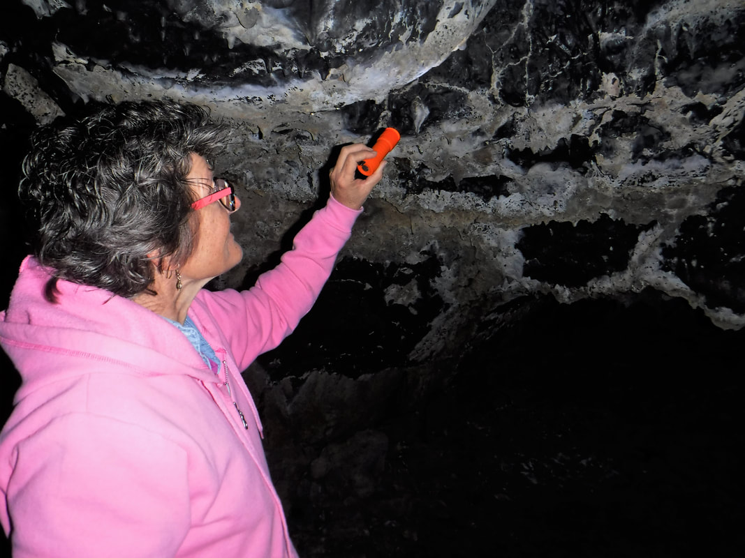
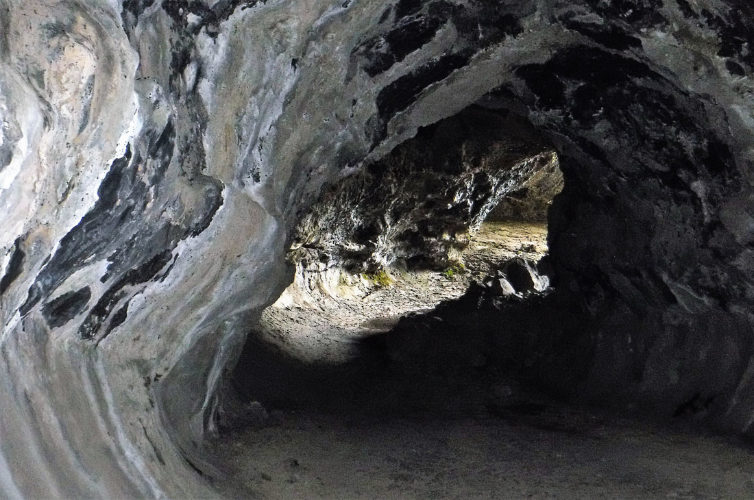
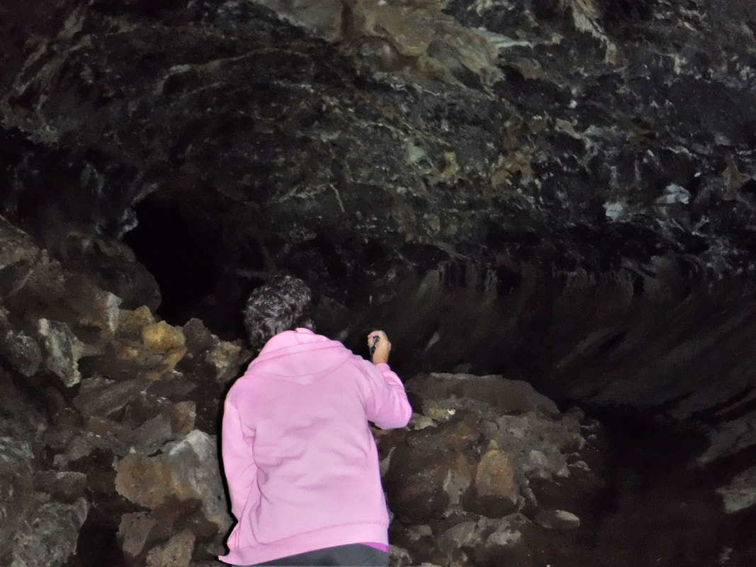
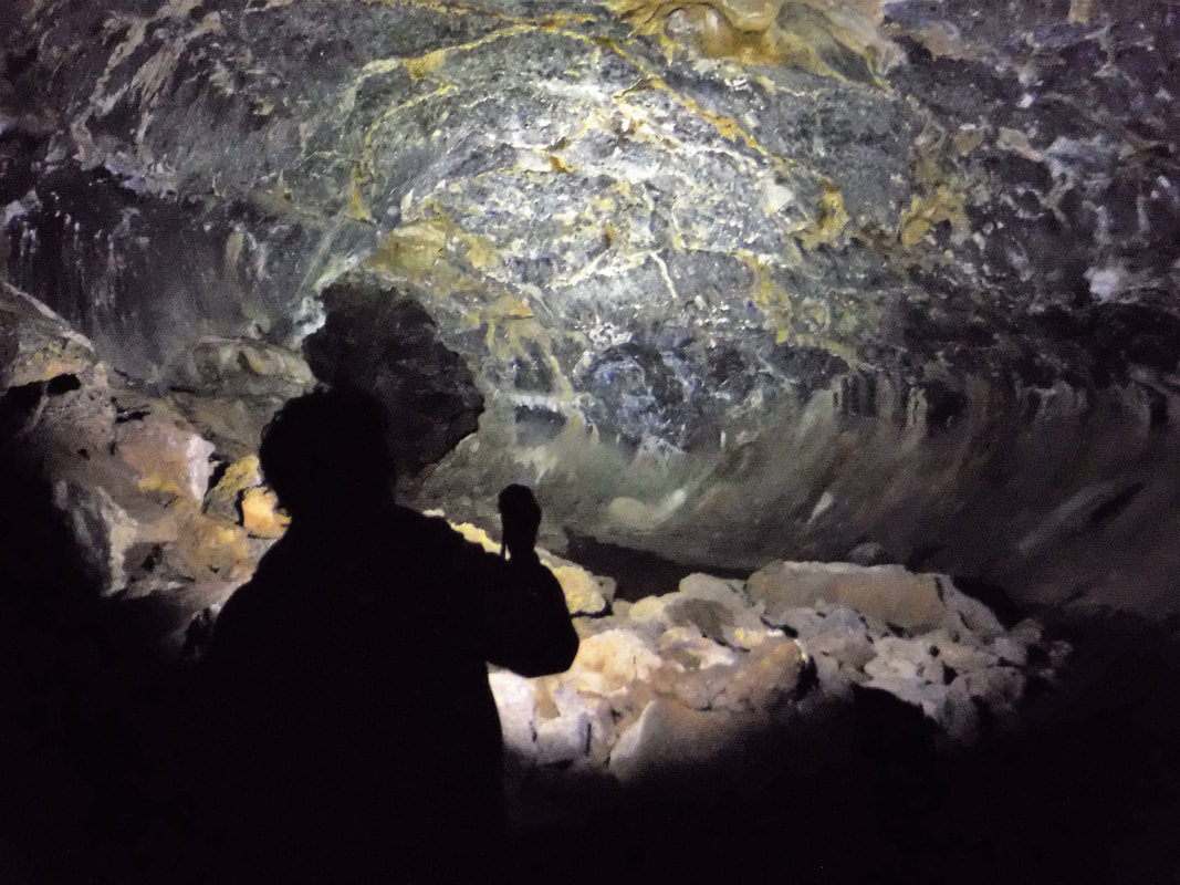
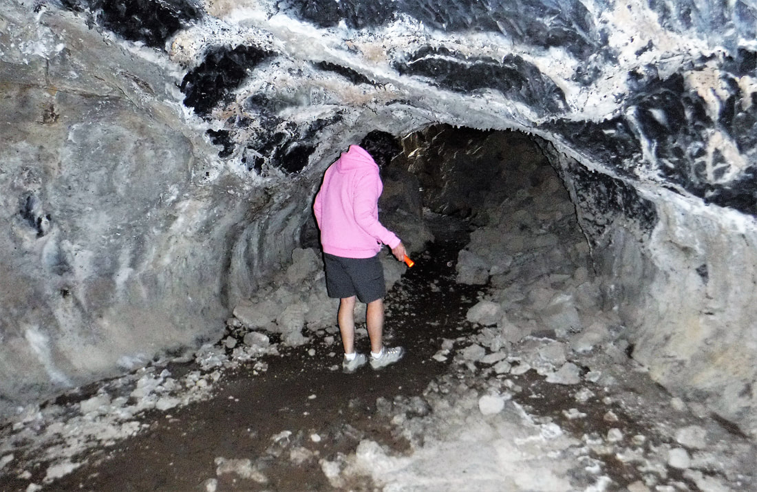
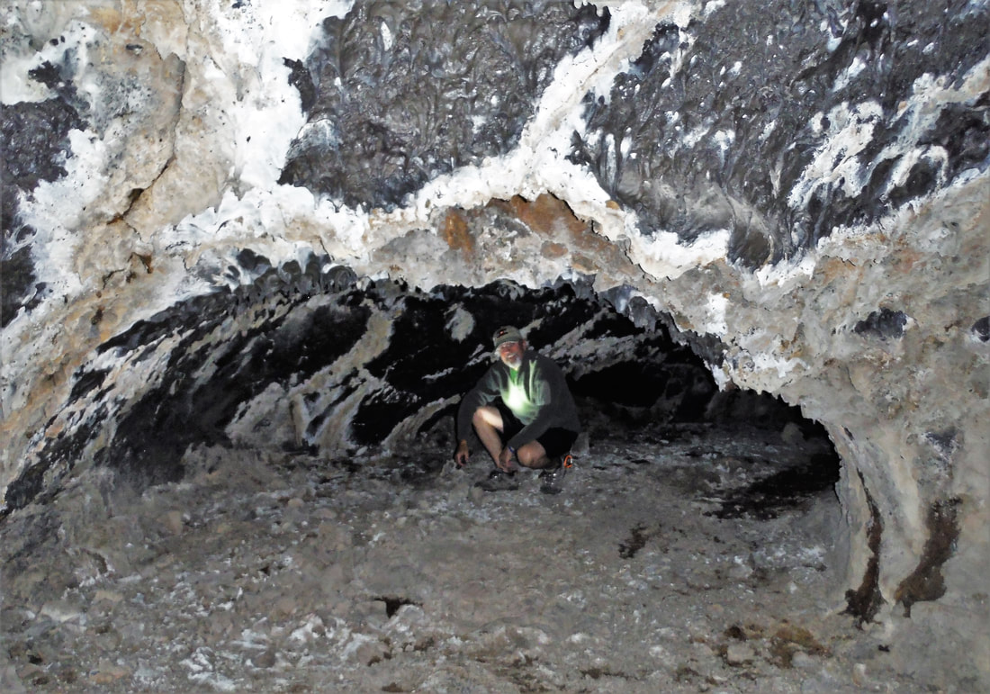
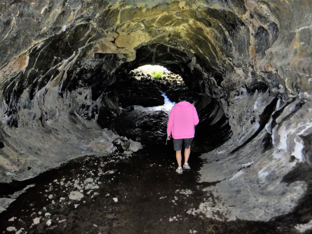
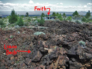 | [Ken 06/30/2018] I want to be in the group who think this park's name should be changed from "...Beds" to "...Tubes." The best part of this National Monument is what is underground, in my opinion. Yea, above-ground is a landscape full of interesting volcanic cones and a half-dozen sizable lava floes that stripe the California high desert, but what is more fascinating are the hundreds of now empty lava tubes under the surface of the earth. |

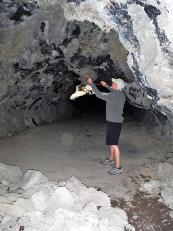
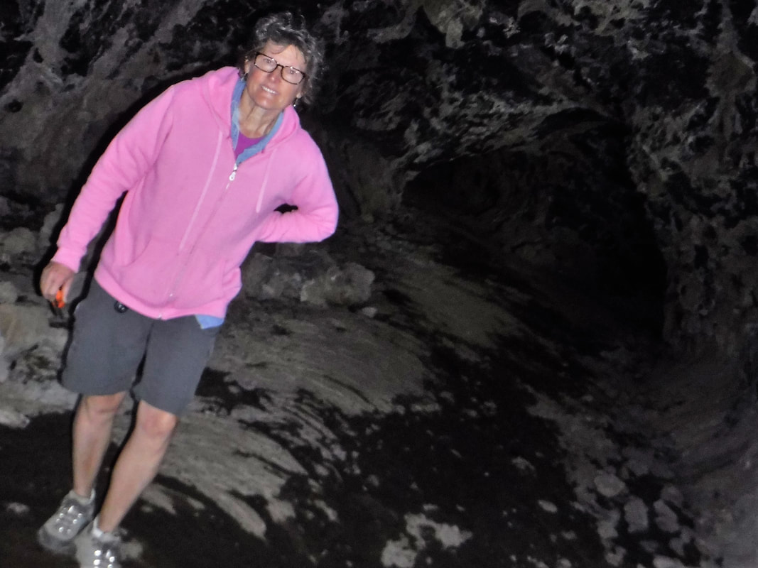
The park map is dotted with trails to "caves." When you explore, however, you discover that these caves are really lava tubes from which prehistoric magma receded, settled, solidified, and left behind a fairly flat expanse for walking. The walls and ceilings, however, still expose evidence of once melted and eerie-looking dripping rock. And there are rippled layers and colors of sagging, hardened rock, too, based on the geologic path the volcano interrogated. Deb commented that it looked like we were walking through the belly of a whale in one spot. For me, the tubes looked otherworldly -- like the backdrop for a scene or two from Star Wars. It was unlike anything that I had ever seen. I mean, frozen-in-time, dripping rock, REALLY?!?
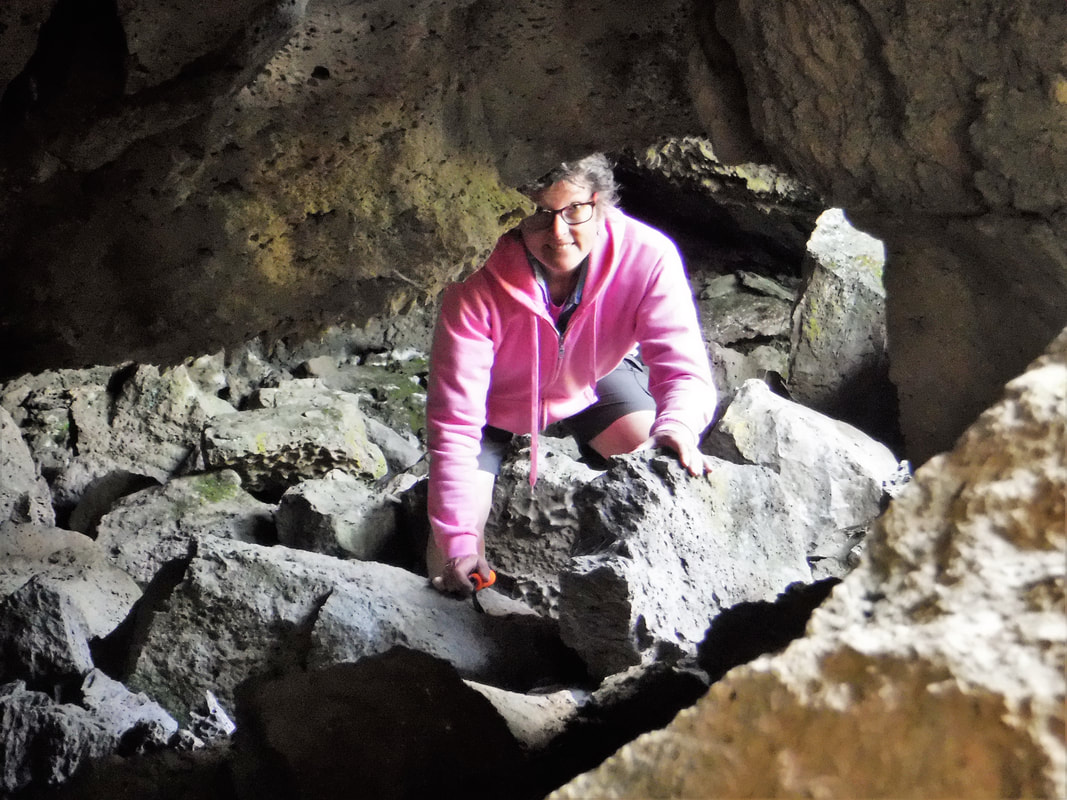
The pictures below seem to illustrate well-lit catacombs. Let me assure you that all of the light we had was from two small flashlights and the flash on our cameras. In real-life, once you have moved away from places where the tubes penetrated the surface of the earth, the "caves" are as dark black as pre-historic pitch.
The pictures below seem to illustrate well-lit catacombs. Let me assure you that all of the light we had was from two small flashlights and the flash on our cameras. In real-life, once you have moved away from places where the tubes penetrated the surface of the earth, the "caves" are as dark black as pre-historic pitch.


CLICK ON ANY IMAGE ABOVE TO ENLARGE and SCROLL
| Located in extreme northern California, this National Monument is an out-of-the-way destination, but worth the effort. Once you have been "sanitized" by the park staff (to mitigate the spread of white-nose bat disease), most of the "caves" are self-paced and self-guided -- all you need is a sweatshirt and a good flashlight (it is very dark inside!). You may also want to bring extra batteries. The National Park Service has categorized a dozen or so of the more popular "caves" by their difficulty so you can know a little about what you would be getting into before personally undertaking the steep descent into alien darkness. | Deb and I explored "caves" rated both Easy and Most Difficult and found you could see and experience quite a lot on both without having to use any special spelunking skills. The length of the "caves" vary from a few hundred feet to more than a mile long. If adventure is your thing, we saw several open, inviting crevices where knee pads would be a good idea. If you would like to go on a guided tour, the park offers a couple options (reservations required). If you are interested in a paved and lighted path, the park offers a "cave" like that, as well. In any case, "Watch Yer Head!" |
|  |
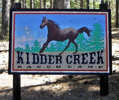
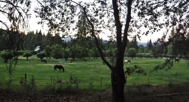
[Ken 06/29/2018] We nestled in on the side of a gentle hill overlooking an apple orchard and a lush horse pasture at Kidder Creek Orchard Camps near Etna, California. It is beautiful country here in the Scott River Valley. We are bordered on three sides by the Marble Mountains of the Pacific Coast Range. At 3000 feet in elevation, Redwood, Ponderosa, and Sugar Pines create a canopy of shade. We were lucky to get a campsite with a great view overlooking a beautiful part of the facility.
KCOC is an adventure camp destination for parent organ-ization, Mount Hermon Camp near Santa Cruz, CA. Mount Hermon, by coincidence, is where two of our prior pastors now serve: Dave Burns from Foothills Bible Church, and Mike Romberger from Mission Hills Church, both in Littleton, CO.
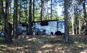
THE VIEW OUT FAITH'S DINING ROOM WINDOW