
where the mountains
meet the sea
[Ken and Deb 06/23/2018] We were between SOWER projects and decided to make a quick drive up famous USHighway 101 (the Oregon Coast Scenic Byway). Legislation enacted in 1967 preserves the remarkable and unspoiled Oregon coast for everyone Most of it is accessible to the public in the longest string of back-to-back-to-back (...) State Parks that we have ever seen.
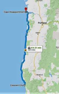
The Oregon coast is about 360 miles long, but we added a few California miles and a little bit in Washington State to our route. In all, we stopped at eleven lighthouses, about as many scenic roadside viewpoints, six beaches, hiked six trails, and visited one-and-a-half forts. Deb got to reach in the candy bag nine times; Ken did not fare so well, usually being the second one in the car to see a light house. Or a fort. Or to note we had crossed a state line.
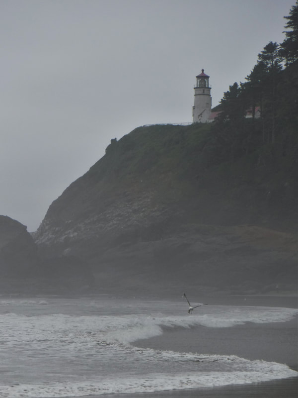
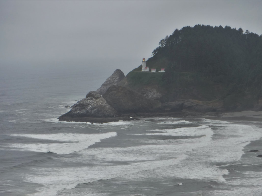
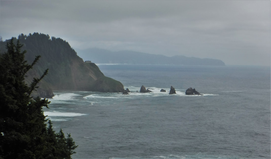
Several people had recommended this exceptionally panoramic road trip -- we wanted to see it for ourselves. Unfortunately, a storm tried to move across the coast on one of our tour days, so the "exceptional panoramas" were sometimes a bit monochrome inside the fog, but the other days were spectacular!
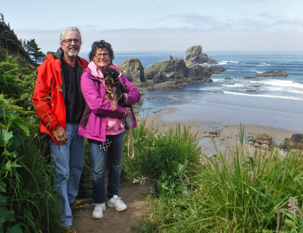
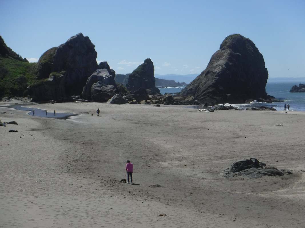
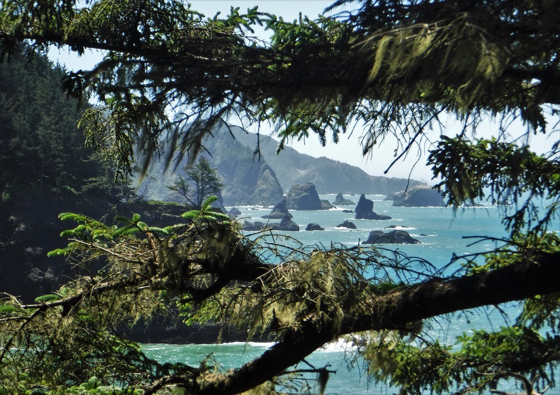
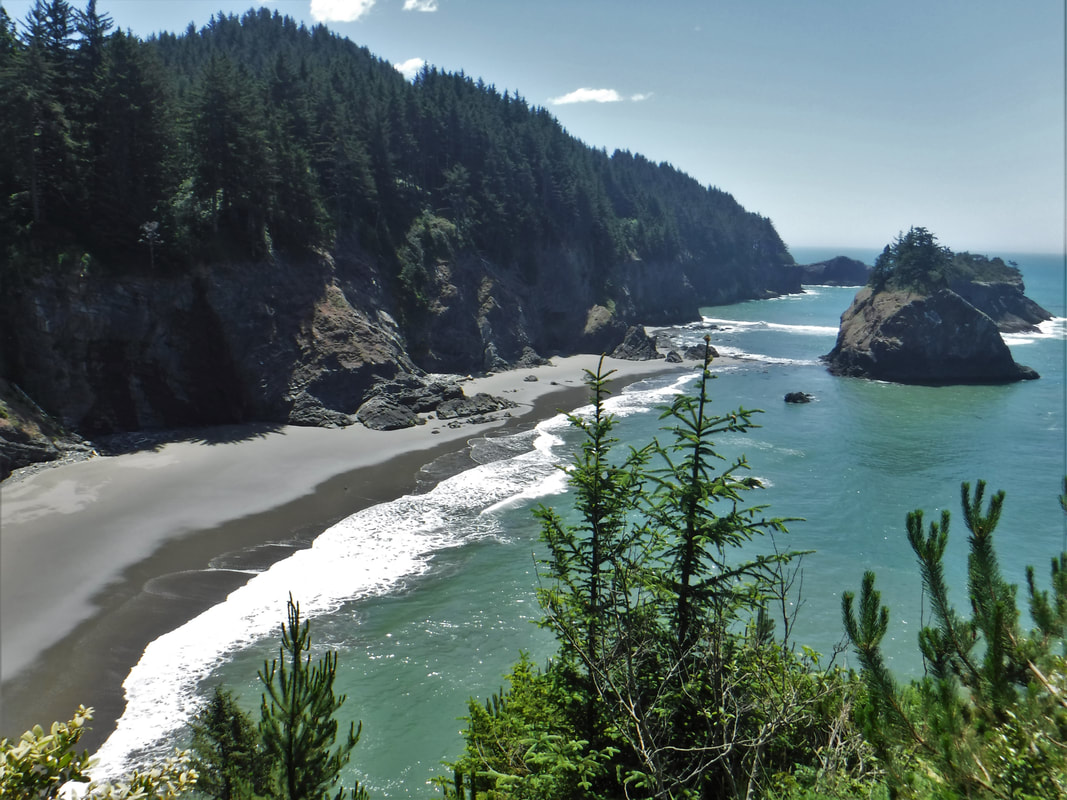
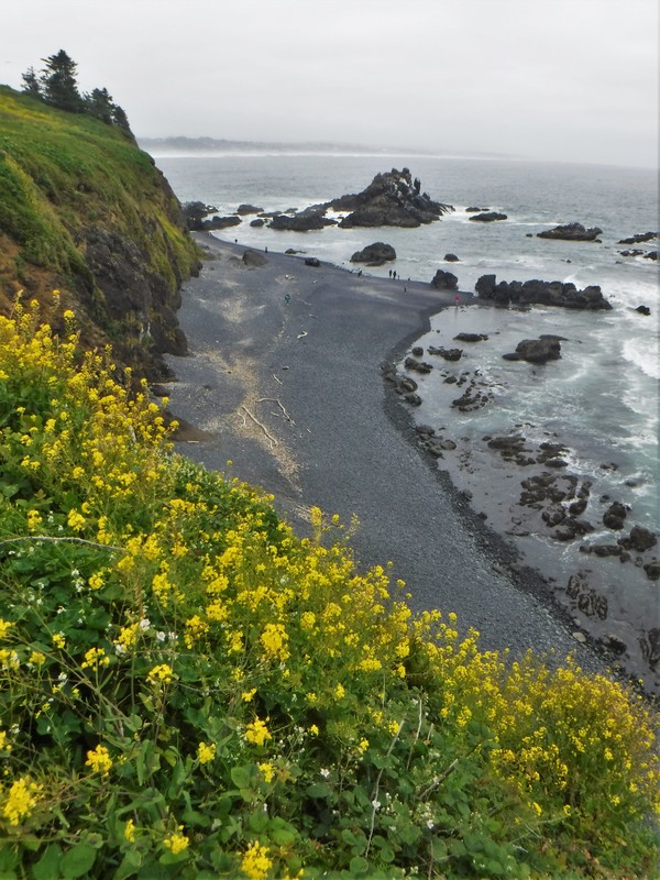
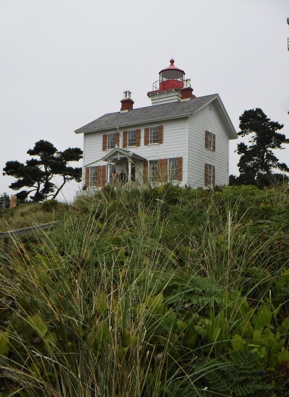
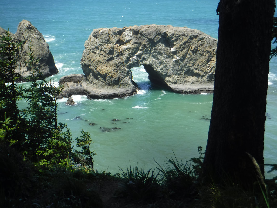
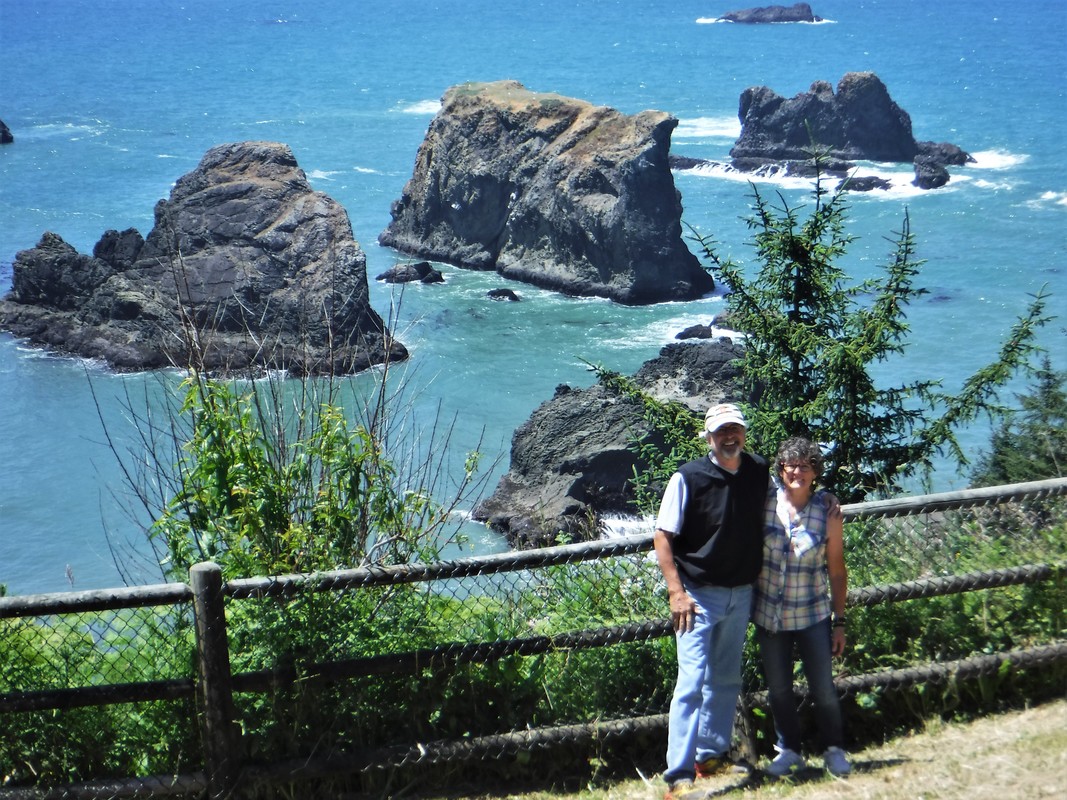
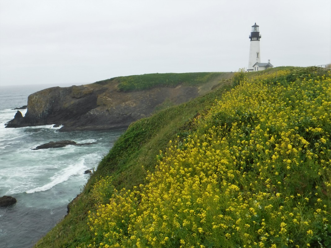
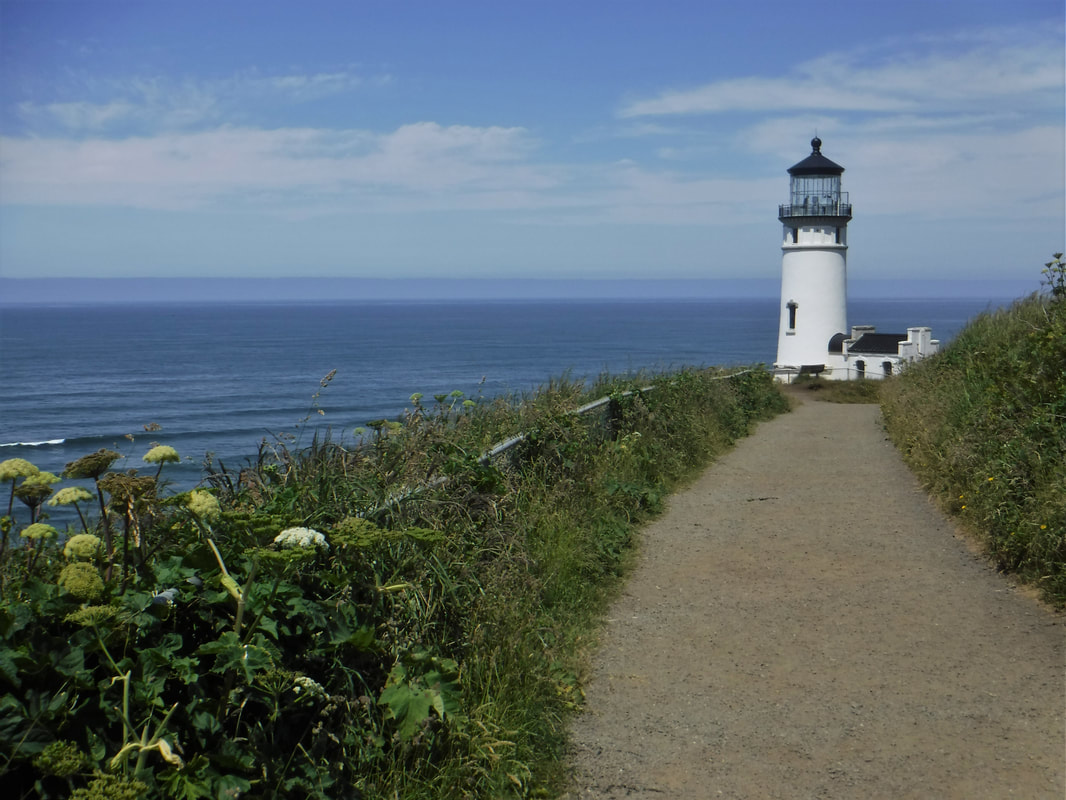
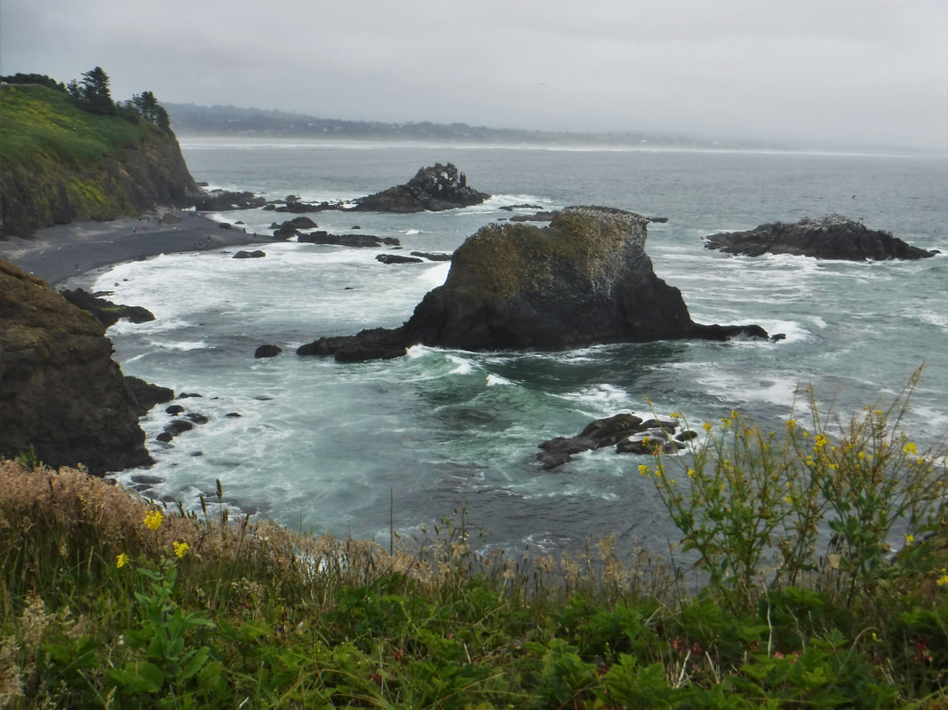
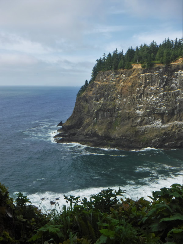
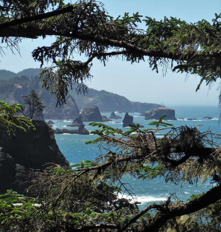
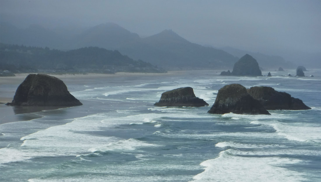
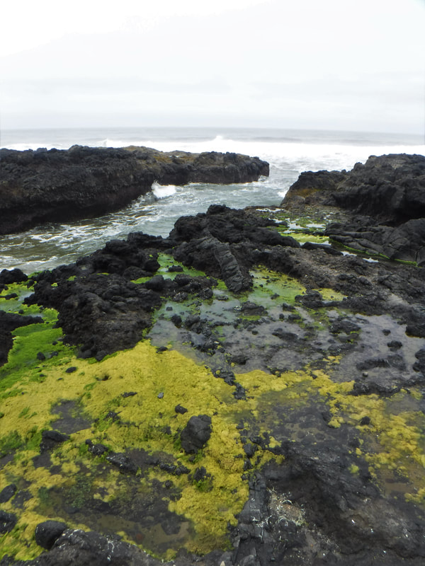
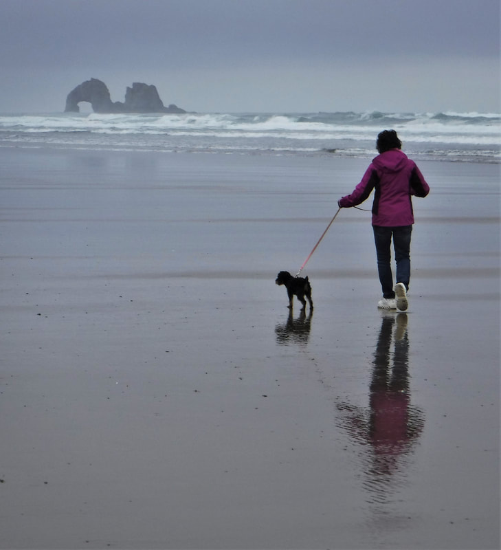
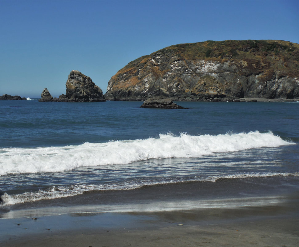
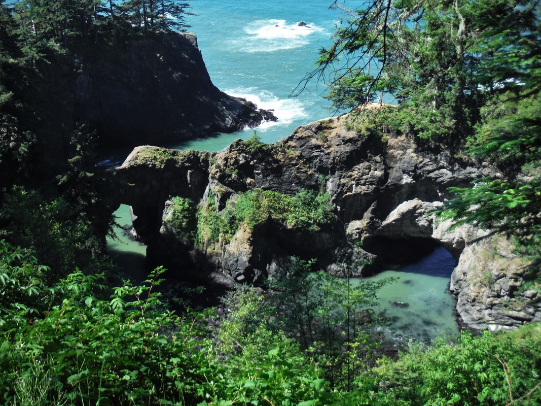
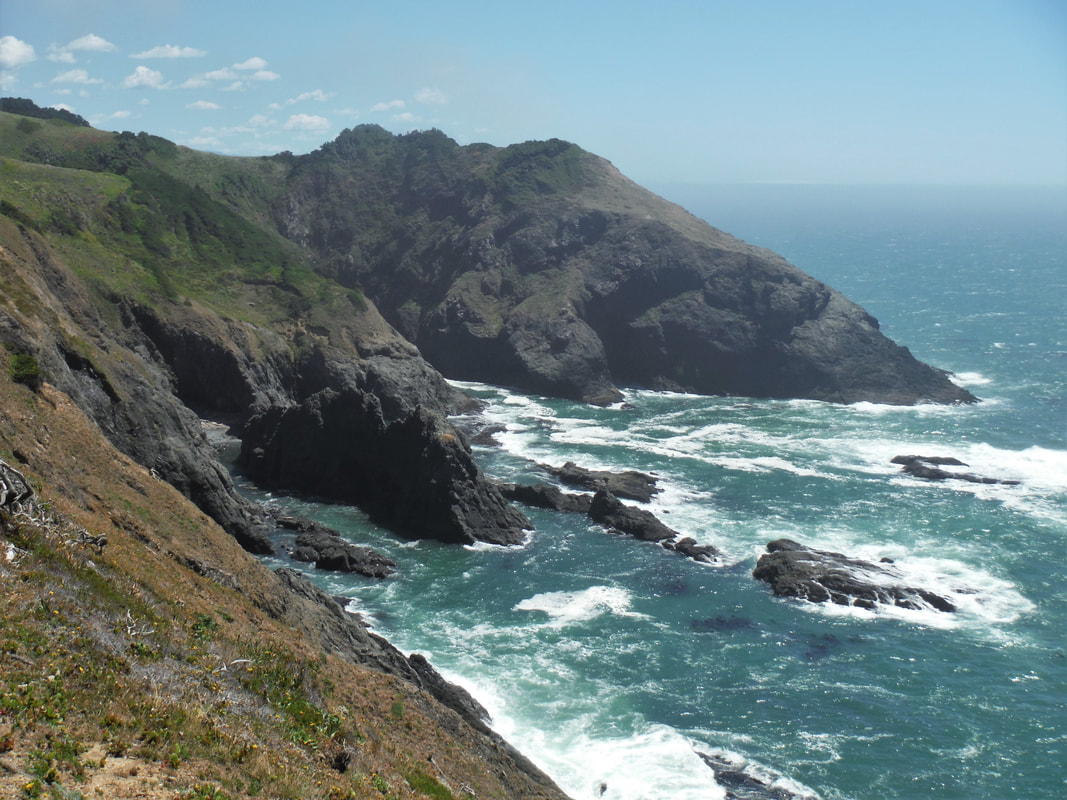
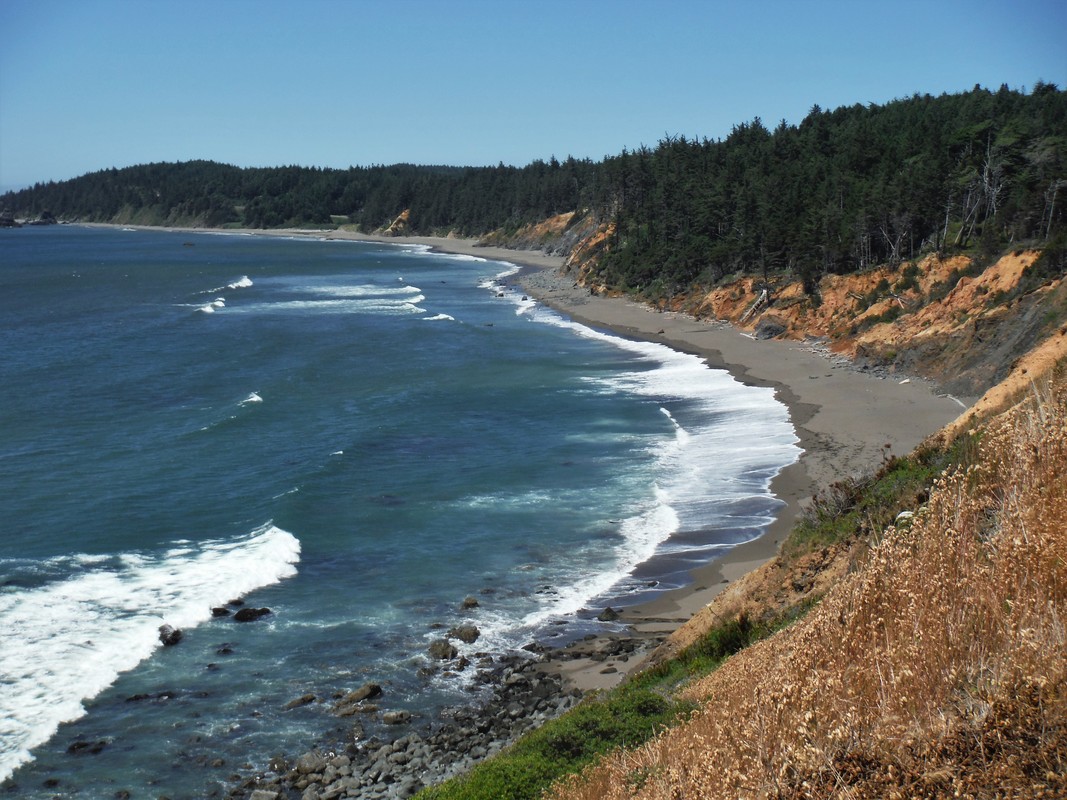
Oregonians don't refer to this saltwater state-line as a simple beach, and it is easy to understand why once you get a peek. Words alone are inadequate to describe the eminent, endless Pacific horizon, edged by a dramatically bouldered coast, and punctuated by historic harbors, coastal villages, and 'art deco' bridge-spans. There are precipitous lighthouses, pods of frolicking whales (can whales frolic?), climactic surf, secret bays, and countless miles of redwood-topped, mountain grandeur. It was scenery overload! So, no more words -- pictures will have to tell the rest of our story....
The Oregon coast is about 360 miles long, but we added a few California miles and a little bit in Washington State to our route. In all, we stopped at eleven lighthouses, about as many scenic roadside viewpoints, six beaches, hiked six trails, and visited one-and-a-half forts. Deb got to reach in the candy bag nine times; Ken did not fare so well, usually being the second one in the car to see a light house. Or a fort. Or to note we had crossed a state line.
Several people had recommended this exceptionally panoramic road trip -- we wanted to see it for ourselves. Unfortunately, a storm tried to move across the coast on one of our tour days, so the "exceptional panoramas" were sometimes a bit monochrome inside the fog, but the other days were spectacular!
Oregonians don't refer to this saltwater state-line as a simple beach, and it is easy to understand why once you get a peek. Words alone are inadequate to describe the eminent, endless Pacific horizon, edged by a dramatically bouldered coast, and punctuated by historic harbors, coastal villages, and 'art deco' bridge-spans. There are precipitous lighthouses, pods of frolicking whales (can whales frolic?), climactic surf, secret bays, and countless miles of redwood-topped, mountain grandeur. It was scenery overload! So, no more words -- pictures will have to tell the rest of our story....

CLICK ON ANY IMAGE ABOVE TO ENLARGE and SCROLL
"...Where seagulls soar over a sunlit bay.
Perhaps, someday, we'll meet again,
And talk of happy times.
Where salty breezes sway tall trees,
And the mountains meet the sea..."
--excerpt from poem by Dee Daffodil
Gadget's first flirt with an ocean. The ocean won!
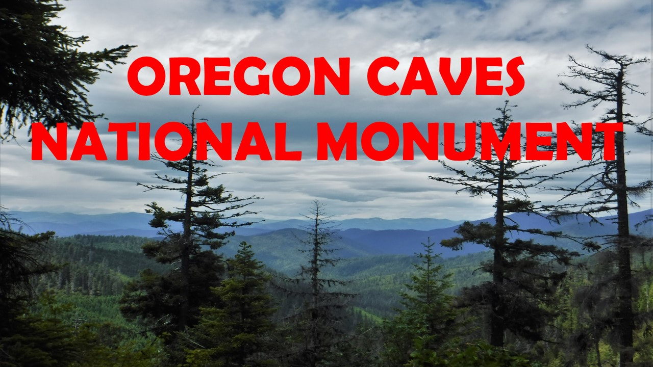
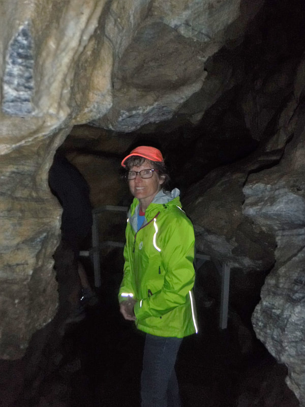
[Ken 06/08/2018] I've been in a lot of caves. My oldest memory is Old Man's Cave in Hocking HIlls, OH; I was five or six. As a teen, our Boy Scout troop loved spelunking and would do cave trips regularly: there's Wyandotte Cave in Indiana where my dad got wedged against a choke stone while crawling though a flattener (his belt buckle was too large -- at least that's the story he told). And Carter Cave in Kentucky where the troop had to strip to our underwear and swim part of the way through the cave (brrrrr!). And Seneca Caverns in West Virginia. Then there are family trips to Tom Sawyer's Cave, MO, Jewel Cave, SD, Cave of the Winds, CO, and Meramec Caverns, MO. And there are repeat trips to Carlsbad Caverns, NM, and Mammoth Cave, KY, of course. Last year, my brother Geoff joined Deb and me and we toured Ozark Caverns in central Missouri. There are a lot of cave tours that I am forgetting, I am sure.
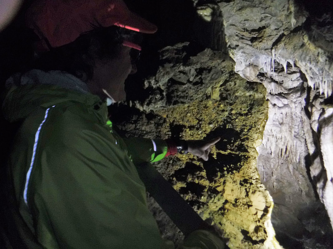
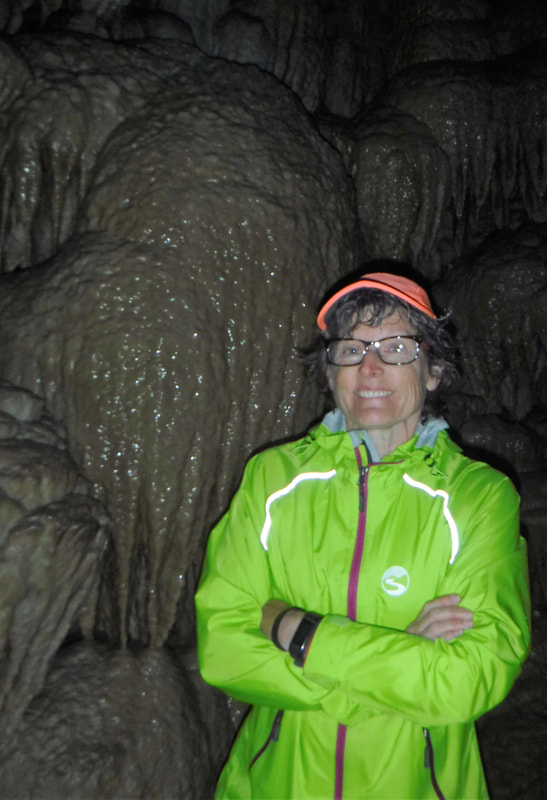
But until today, I have never been in a cave like the one at Oregon Caves National Monument. First, it is a cave that is in the top of a mountain -- I think of caves usually being found in lowland areas. And second, it is not a limestone cave. According to the Ranger, excluding boulder piles, sea caves ("grottos"), volcanic origin caves ("tubes") and glacial caves ("ice caves"), all but three of the dominant caves in the United States are formed by the acidic water erosion of limestone. Oregon Caves is one of the three that are not limestone caves. The cave here is almost entirely water-eroded marble! Albeit unpolished marble, Oregon Caves has been nicknamed, "The Marble Halls of Oregon."
But until today, I have never been in a cave like the one at Oregon Caves National Monument. First, it is a cave that is in the top of a mountain -- I think of caves usually being found in lowland areas. And second, it is not a limestone cave. According to the Ranger, excluding boulder piles, sea caves ("grottos"), volcanic origin caves ("tubes") and glacial caves ("ice caves"), all but three of the dominant caves in the United States are formed by the acidic water erosion of limestone. Oregon Caves is one of the three that are not limestone caves. The cave here is almost entirely water-eroded marble! Albeit unpolished marble, Oregon Caves has been nicknamed, "The Marble Halls of Oregon."

CLICK ON ANY IMAGE ABOVE TO ENLARGE and SCROLL
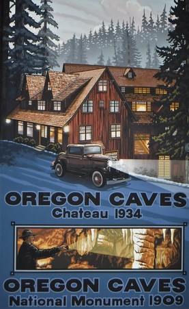
A good picture is hard to take while traipsing through a dimly lit cave, so I'll add a few words. Predictably, there are a lot of narrow passages, steep stairs, and rocks that look like George Washington's profile. There are cave kisses here-and-there (drips from the ceiling) and plenty of dramatic lighting focused on choice stalagmites, stalactites, columns, and draperies. Unlike Carlsbad or Mammoth, there is only one large room, but it has a ghostly story. All of this considered, it's the marble canvas on which all of this is painted that made Oregon Caves so interesting to me.
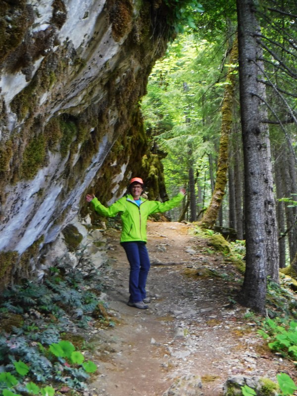
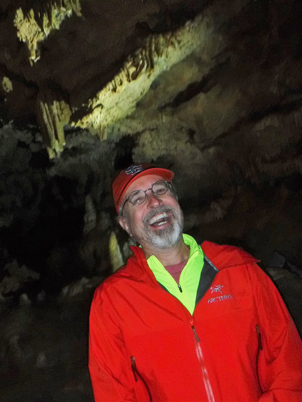
The Discovery Tour was about one mile, 500 stairs, and ninety minutes. The Park Ranger leading our tour was once "dishonorably dispatched" from The Gong Show, so there were quite a few bad jokes to distract me from the throbbing knot on my forehead (I misjudged a low, 45" passage). The temperature is quite cool inside at 44 degrees year-round. If you go on the tour, reservations are encouraged.
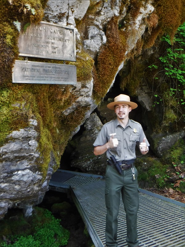
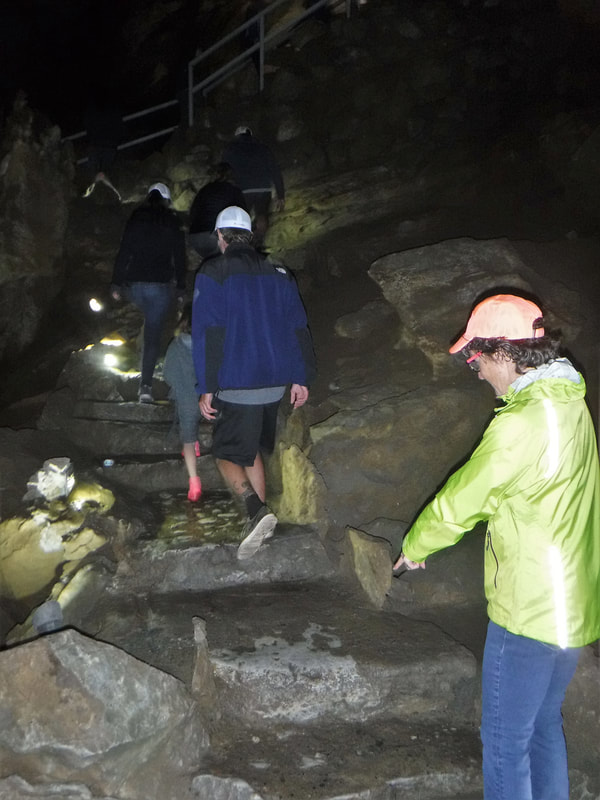
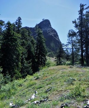
The summit of the tour finds you exhaled through a different cave orifice than the one you entered. When you finally see daylight again, you are about 220 feet higher on the mountain, and eight-tenths of a mile farther away from the Visitors Center. The self-guided trail back, however, takes you outside, up, over the top of the same dome that you saw on the tour, from beneath, just a few minutes before. The view from the mountain's acme is worth the extra hike (see the picture on the title slide of this blog entry). If you like wild flowers, the hike will be even more enjoyable.
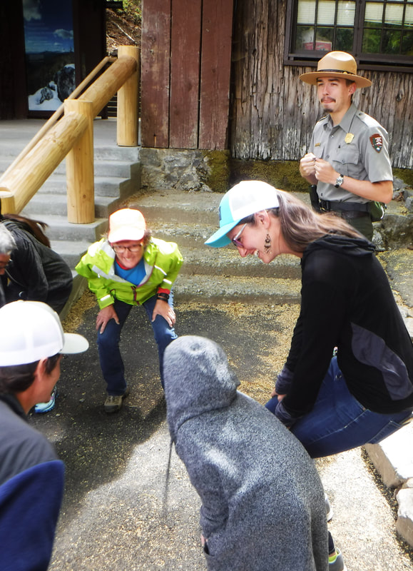
On our way back to the car Deb and I agreed that this was one of the most interesting cave tours we have been on. And the first cave where we had to demonstrate we could squat-waddle like a duck before going on the tour. We give it two bat-thumbs up!
The Discovery Tour was about one mile, 500 stairs, and ninety minutes. The Park Ranger leading our tour was once "dishonorably dispatched" from The Gong Show, so there were quite a few bad jokes to distract me from the throbbing knot on my forehead (I misjudged a low, 45" passage). The temperature is quite cool inside at 44 degrees year-round. If you go on the tour, reservations are encouraged.
The summit of the tour finds you exhaled through a different cave orifice than the one you entered. When you finally see daylight again, you are about 220 feet higher on the mountain, and eight-tenths of a mile farther away from the Visitors Center. The self-guided trail back, however, takes you outside, up, over the top of the same dome that you saw on the tour, from beneath, just a few minutes before. The view from the mountain's acme is worth the extra hike (see the picture on the title slide of this blog entry). If you like wild flowers, the hike will be even more enjoyable.
On our way back to the car Deb and I agreed that this was one of the most interesting cave tours we have been on. And the first cave where we had to demonstrate we could squat-waddle like a duck before going on the tour. We give it two bat-thumbs up!
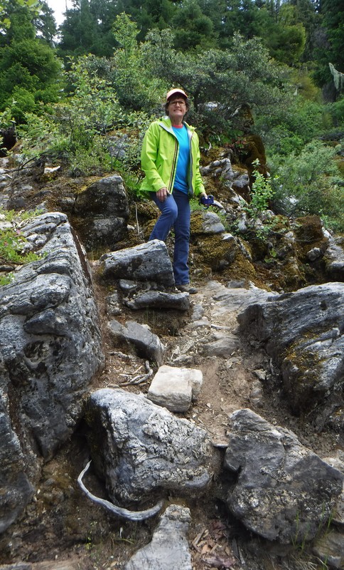
 | oregon at elevation[Ken 06/02/2018] We heard about a new park facility in the area -- officially added to the US roster of parks in 2017 -- we just had to go and explore it. Cascade–Siskiyou National Monument preserves the unique columnar shaft geology of two converging mountain ranges: the southern Cascade Range and the eastern Siskiyou Mountains. At 6000 feet in elevation, the altitude is not high by Colorado standards, but with all of the snow-capped peaks around, it sure felt like Colorado! |
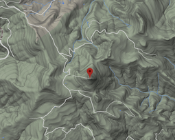
The most prominent feature in the monument is Pilot Rock, a plugged volcanic tube frozen in time. It tops out at 5910 feet in elevation and is so embossed on the horizon that it is visible from 40 miles south in California. Pilot Rock reminds me of the way that Devils Tower (Wyoming) punctuates the sky -- and the two monuments are similarly formed. It is also visible from a branch of the Oregon Trail -- like a pin stuck conspicuously in a map, Pilot Rock was a reliable navigation tool for the wagon trains traveling Emigrant Pass.
Several foot trails cross the national monument including the scenic and well-traveled Pacific Crest Trail, and we noted that the PCS goes right by Pilot Rock. That's all we needed to know -- there is a trail that will lead us to Pilot Rock! And it starts at Siskiyou Pass, almost to California and the highest point on Interstate 5. Challenge accepted! We were on our way!
Several foot trails cross the national monument including the scenic and well-traveled Pacific Crest Trail, and we noted that the PCS goes right by Pilot Rock. That's all we needed to know -- there is a trail that will lead us to Pilot Rock! And it starts at Siskiyou Pass, almost to California and the highest point on Interstate 5. Challenge accepted! We were on our way!
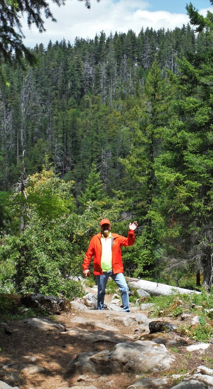
| | Off the Interstate, after a couple miles of rough-and-rocky roads, we located the trailhead near an abandoned quarry. Jarred and rattled, Gadget was ready to get out of the shaking car and onto some solid ground (Deb and me, too!). So we were off on what would become a day-hike of long switchbacks, volcanic climbs, and spectacular panoramic scenery. |
For the first mile, the trail was green, lush, and covered with the needles of the Douglas Fir and redwood trees that loomed over head. But then the ascent started ... reasonable at first, but ever steepening as we went on. And on. Steeper and higher. The final ascent turned into a 50+ degree rock slope! In places, it was like climbing a ladder -- so steep that you had to hike it on your hands and feet!
In 3.79 miles, we rose just under 1000 vertical feet. By "we" I mean Deb and me and Gadget. Gadget has become an intrepid hiking companion. Its amazing how far and how fast she can go on a few laps of water and a couple crumbs of beef jerky! Too bad that she was too short to see all of the amazing scenery!
In 3.79 miles, we rose just under 1000 vertical feet. By "we" I mean Deb and me and Gadget. Gadget has become an intrepid hiking companion. Its amazing how far and how fast she can go on a few laps of water and a couple crumbs of beef jerky! Too bad that she was too short to see all of the amazing scenery!
| 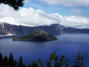 |
[Ken 06/01/2018] It is just a short drive from our camp in southern Oregon. The weather report looked great but it appeared there might be several roads that are closed -- we may not be able to drive the 33 mile rim route around the lake at Crater Lake National Park. But if we could get to the rim and access one of the trails it would be worth it!
We arrived at the park gate at the same time as the hundreds of other curious and hopeful tourists to Crater Lake on this day. As the assortment of cars, RVs and tour buses squeezed through the gauntlet of entrance stations, we all had the same question of the presiding ranger in the booth. And we all heard the same answer, "Due to accumulated snow, all of the rim roads are closed except for a short section of the western rim drive...". Bummer!
We proceeded, regardless -- Crater Lake was on Deb's 'Bucket List' and we needed to cross it off. At the rim village we eagerly assumed the last remaining parking space and slogged out into the snow. It had been several years since Deb and I had hiked in snow, and the first time ever for Gadget. It was actually a pretty reminiscent sensation, and Gadget liked it, too.
| | Crater Lake is famous for its deep blue color and for the clarity of its water. The lake rests in the caldera of an extinct volcano at the elevation of 6178 feet above sea level; the rim rises another 2000 feet(+/-) above that. Crater Lake is the deepest in the United States -- measuring 1943 feet deep (ninth deepest lake in the world). It is worth the drive to see, even if you don't get to more than one vantage point. |
Other than the beautiful, deep-blue lake, the most noticeable thing about our visit to the rim of the caldera was that Deb and I were the only ones speaking English! As we toured the rim village it sounded like we were at the International Terminal in Hartsfield-Jackson Atlanta Airport. "This must be one of the go-to spots for travel agencies around the world!", we thought.
Unfortunately, we were not able to access any "up top" trails. And because of tour bus congestion in snow-clogged parking lots, we did not access any of the short section of the rim drive that had been plowed. But we did access a hiking trail to a beautiful waterfall outside the park. And a tasty meal and a slice of huckleberry pie at 'Beckies Place' on the way back down-the-hill. Yummmmm! Worth the trip!
Unfortunately, we were not able to access any "up top" trails. And because of tour bus congestion in snow-clogged parking lots, we did not access any of the short section of the rim drive that had been plowed. But we did access a hiking trail to a beautiful waterfall outside the park. And a tasty meal and a slice of huckleberry pie at 'Beckies Place' on the way back down-the-hill. Yummmmm! Worth the trip!
dog paddle
not required
| |


CLICK ON ANY IMAGE ABOVE TO ENLARGE
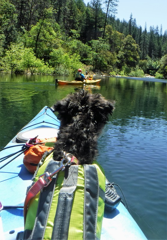
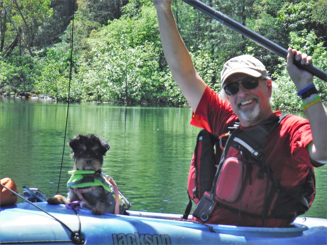
[Ken and Deb 05/28/2018] We took a quick trip to Applegate Lake in southern Oregon. It was our first paddle of the season. And our first one ever with a puppy as a passenger. But not to worry, dressed for the day, Gadget took to the kayak like vanilla ice cream on a warm slice of marionberry pie (hint, hint). She hardly whimpered, but did let out a "grrrrrr" when Deb's kayak got a little close to Ken's. It was as if she was saying, "Don't you dare bump into me and my kayak!"
She was a good lookout -- calling attention to all of the doggies romping on the shoreline and paying especially close attention when a fish jumped or a bird flew near. It was her first time to cross the state line into California, and Ken's first time to kayak across a state line. Fortunately, Ken and Deb did all of the paddling -- no doggie paddle required this time. WooHoo!
She was a good lookout -- calling attention to all of the doggies romping on the shoreline and paying especially close attention when a fish jumped or a bird flew near. It was her first time to cross the state line into California, and Ken's first time to kayak across a state line. Fortunately, Ken and Deb did all of the paddling -- no doggie paddle required this time. WooHoo!